The weather had called for rain the evening before, and sure enough it did – but it also called for clearing on Saturday and Sunday, so we looked forward to our fall (foliage) weekend in VT – to finally claim Mt Abraham, and Killington on Sunday.

Saturday broke, and we were up and on the road early – planning to drive to VT, hike Mt Abraham and then drive to the Colonial House Inn (our favorite) for a few nights. On the trip north, we ran into some brief rain showers, so we feared a repeat of our last attempt to hike Mt Abraham (when the road had been closed for repairs).
Mt Abraham is the lowest of the five 4000’ summits in Vermont, topping out at 4006’. We planned to approach Mt Abraham from Lincoln Gap Road at the point where the road intersects the Long Trail, at a trailhead elevation of 2400’. This made for a relatively short hike, only 5.2mi round trip, with an elevation gain of roughly 1600 ft.
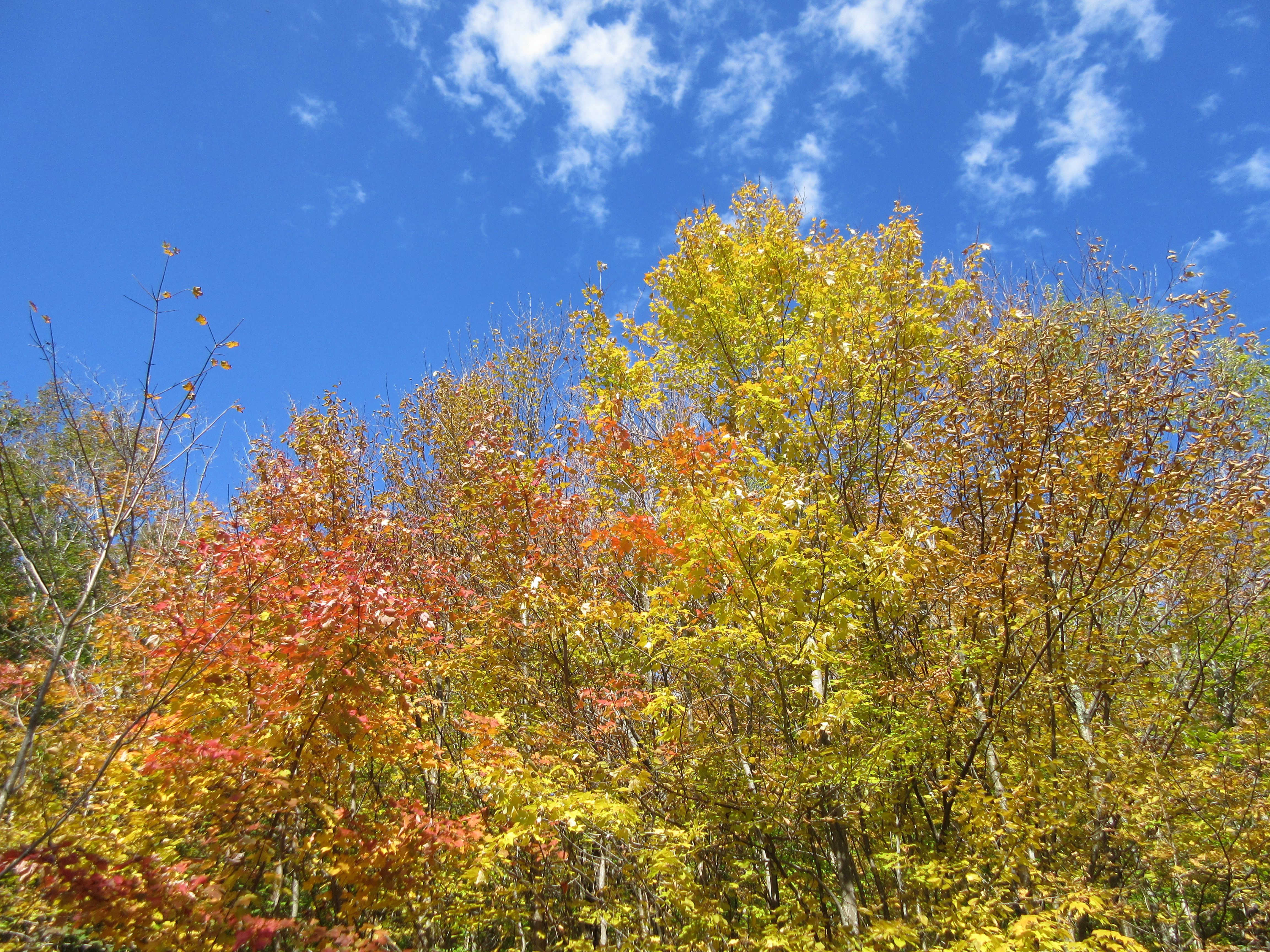
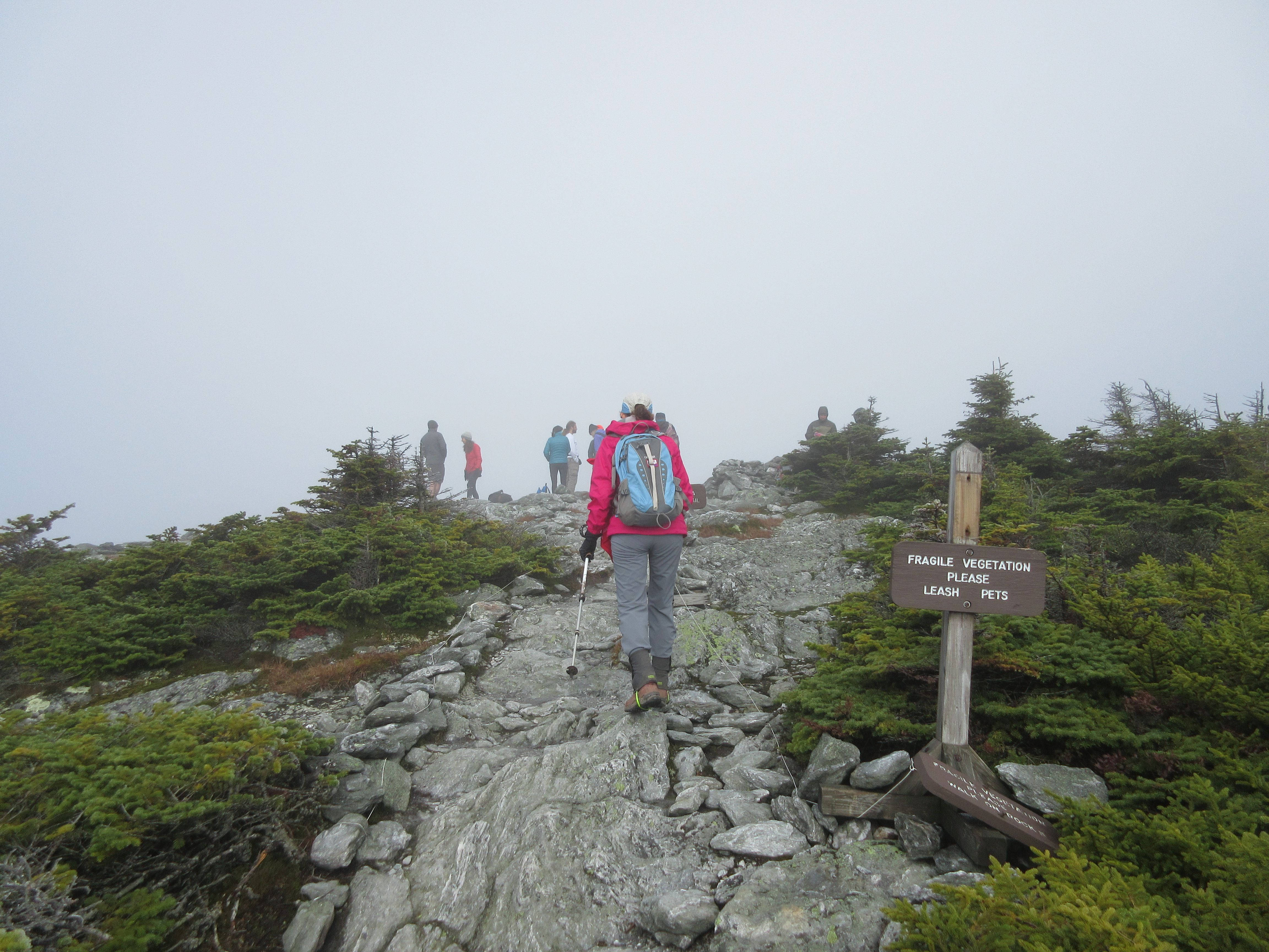
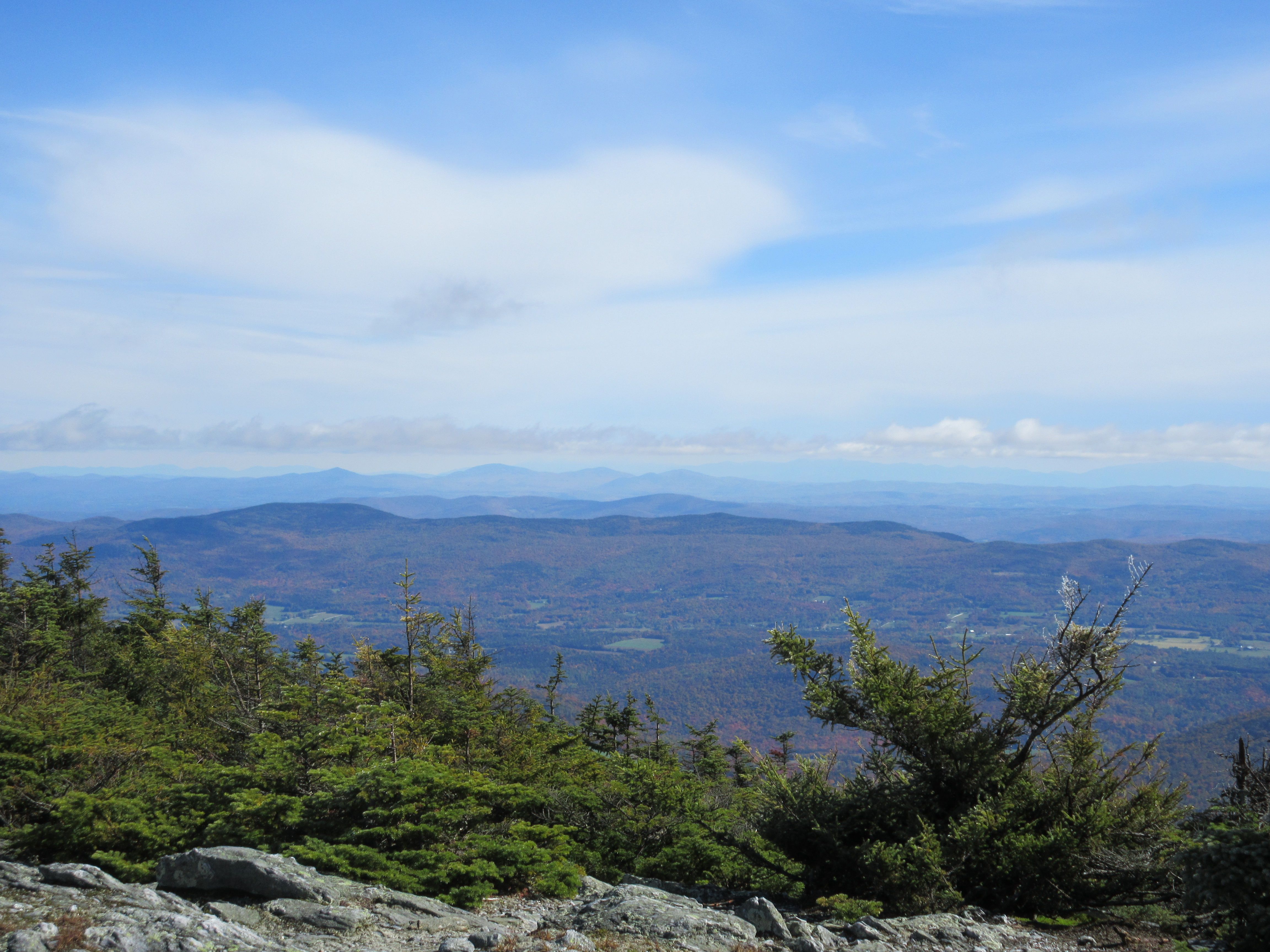
After the nearly 4 hour drive, it was great to get out of the car and stretch our legs. The parking area was already crowded though we were able to find a space. It was chilly, only the low 40’s, so we quickly got our gear on and were on the trail at 10am. The trail was wet and sloppy from the start, and started gaining elevation immediately, which meant we had to pay careful attention to the footing. Fortunately though, as we ascended, the weather began to clear as predicted, with less threat of rain showers. As we neared the summit, the fog and low-lying cloudiness gave way to sunshine, and we were rewarded with some awesome views. The view to the left was eastward – in the far distance, just right of center, you can make out the Presidential Range – nearly 80 miles distant!
There was a persistent wind on the summit, so a few more photos, including first few snowflakes of the season, and we headed below the summit to a sheltered area for a quick trail lunch. A few more minutes to enjoy the views and we started our descent, amazed at the number of people whom we saw ascending – at least two dozen or more. We were back at the car shortly after 1:30 and on the road for the 70 mile drive south on Rt. 100 to the Colonial House, now treated to some of fine views and foliage that Vermont has to offer this time of year!
We always enjoy returning to Colonial House – like coming home to see old friends. Our visits had always been during the winter, so it was pleasant to see green fields and the yellows and reds in the trees out back. Dinner and a quiet evening at the Colonial House and we were off to bed early!
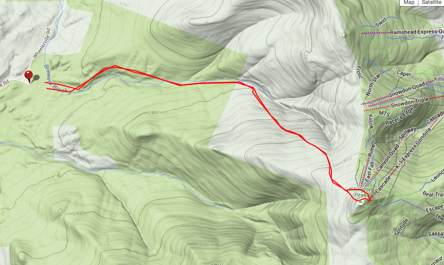
Sunday broke with nearly all sun – only a few passing clouds that appeared they would vanish as the sun went to work during the day. The plan was to head north to Killington for the 7.2 mile hike on the Bucklin trail on the west side of the summit. The trail has an elevation gain of 2500’, a book time of 4hrs 50mins, with a moderate gain for the first 2 miles, rising more steeply for the remainder, capped by a rock scramble for the last .1 miles.
We took our time heading out, preferring to pause and enjoy the scrumptious Colonial House breakfast (!). There was no rush, it was only an hour drive to the trail, and with the shorter book time, we still had plenty of daylight. Like many of our other hikes, the trailhead was off a dirt road that was nearly 4 miles from a paved road; pretty obscure, but thanks to Google and the nav system, we were parked and on the trail shortly before 10:30am. Less popular than Mt Abraham, there were less than a dozen cars in the parking area.
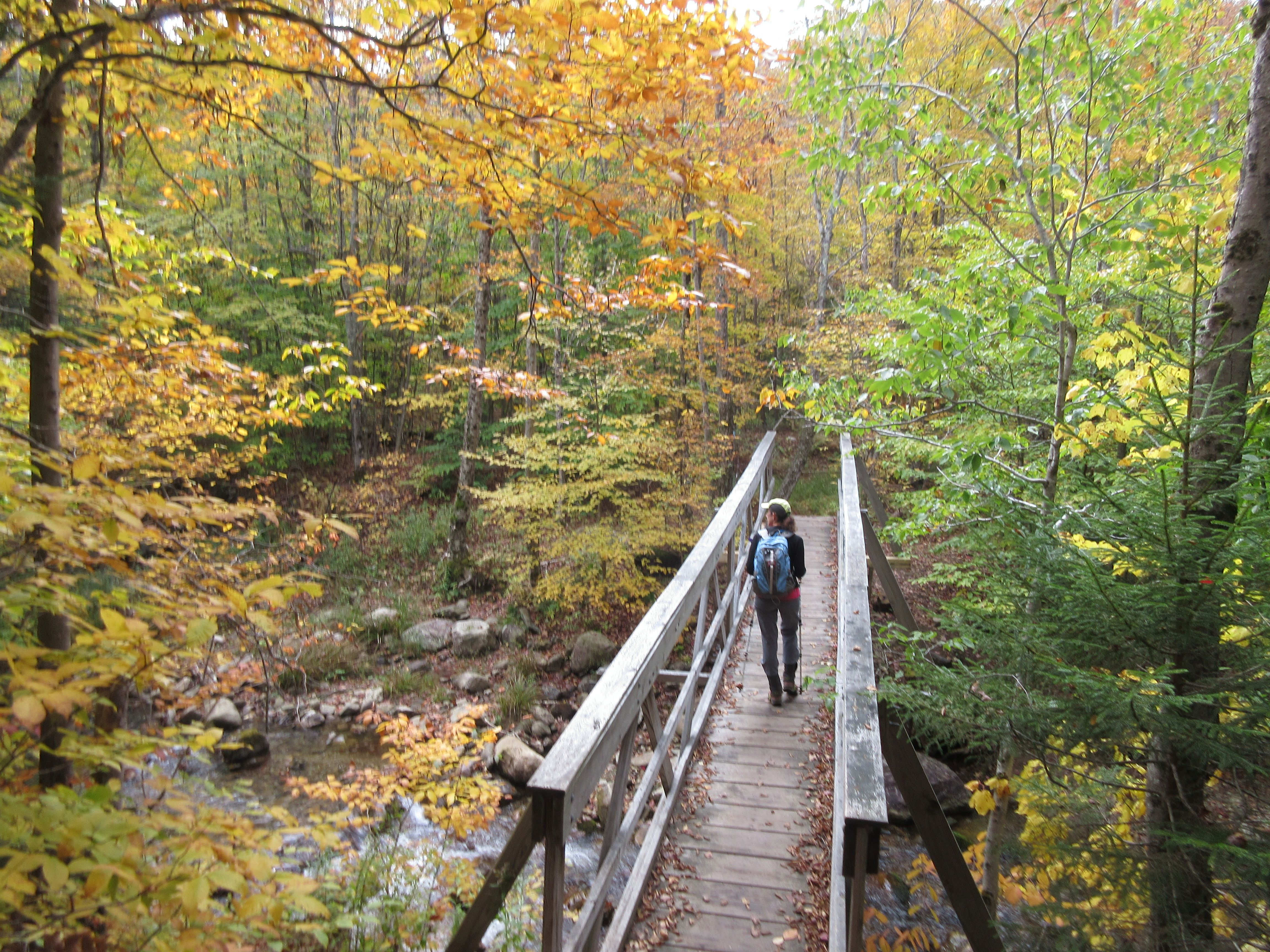
True to the descriptions, the first few miles of the trail were “a walk in the woods” – with a very gradual ascent and wide enough so that we could walk side-by-side – it appeared as if parts of the trail had been old logging roads. The trail followed Brewers Brook, and twice crossed the brook, on solidly built wooden bridges. At about 2 miles, the trail became noticeably steeper, though footing was great – no big boulders or roots to navigate. About a 2/10 mile below the summit, we reached the Cooper Lodge – a shelter for hikers on the Long Trail. The last path to the summit wasn’t clear, so instead of scrambling the rocks as some of the posts mentioned, we (and a group of 3 other hikers) emerged on one of the ski trails near the summit.
The gondolas were running, bringing leaf-peepers to/from the summit. We hiked the short distance to the summit, competing for trail space (and space on a catwalk walkway) with others carrying coffee cups, etc. purchased at the summit lodge. A bit distracting from the woodsy solitude that we enjoyed on the trail, but that’s what it is.

Making our way to the true summit, it was incredibly windy on the summit, so we really didn’t stay long, though we did stop for a few quick photos (but sadly, no coffee this time!). We decided to take the rock scramble downward – so we could find where we went off the trail back at Cooper Lodge. We weren’t off by much, and thankfully, back at the Cooper lodge, we were sheltered from the wind, so we stopped for some food while resting on some empty tent platforms.
Refreshed from a bit of food, we descended rapidly, again the lack of boulders/rocks made the footing easy. We passed a number of other groups, heading to the summit, some less equipped than others. But with the trail conditions and footing, hopefully they made it to the summit. The day and trail were perfect for hiking and being outdoors to enjoy the finest that Vermont has to offer!