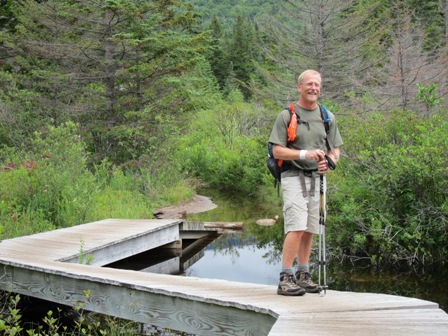
This was one of our “big ones” – our first multi-night hike in the White Mountains and the AMC huts – and a one-day length of over 13 miles! Because the huts are reservations-only and fill up quickly, we’d made our reservations back in January, so we’d been looking forward to this one for some time.
We began our trip, parking the car at Gale River trailhead and catching the AMC shuttle to Zealand trailhead. From there, it was a short 2.8 miles to the Zealand Hut. To our surprise, the trail was an easy, wide grade for well over half of it – we arrived at the hut in 1hr15mins – plenty of time to relax!
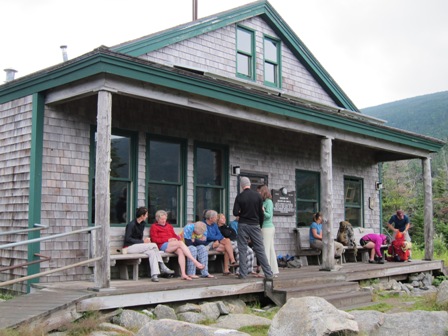
Even with the unsettled weather that we’d been experiencing during the week leading up to the hike, there were quite a few “day trippers” at the hut. One or two groups of what looked like some church or youth groups and, as we found out later, a portion of a scout troop.
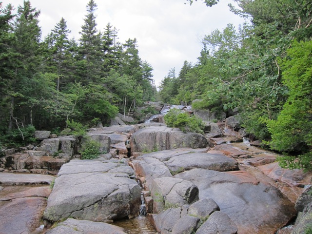
Besides the short hike itself, the Zealand Falls makes for a nice destination day hike, and since any sort of rain held off that afternoon, parts of the falls hosted some day-trippers which, of course, brings along kids who like to climb all over the rocks! In the photo below, no kids, just the cool water falls which made for a nice way to wash off some of the humidity and grime from the hike to the hut.
Dinner and breakfast at the hut was good and it was a (mostly) quite night. Fortunately, we were in a 4-bunk room, with a door, that enabled us to shut out the “snorer” in the other room – but it wasn’t quite enough to shut out another little pest! Part of the dinner announcements included a suggestion to hang up all packs – get all the food off the floor, to keep it away from cute little 4-legged creatures. Well, we may not have been listening too well during those announcements because at about 3 in the morning, we heard something – rustling of a plastic bags of trail mix… Hanging up the pack finally ended that excitement. Saturday breakfast of oatmeal and some egg/quiche thing (with leftover broccoli from dinner!) was a great way to start the day.
The morning weather showed a few more clouds than Friday. The weather announcements of possible showers and T-storms in the afternoon didn’t sound too good, especially with our planned 13 miler (and up to six 4000 footers!) but we had some contingencies in case of really bad weather. So, we set out under overcast skies.
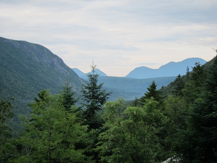
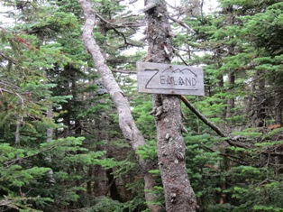
Our first vista was Zeacliff – not on the 4000 list, but some nice views of Carragain peak, Anderson and Lowell. From there, we followed the Zealand Ridge trail getting our first 4000′ – Zealand Mtn. An uninteresting summit, completely enclosed by trees. We were however, rewarded with a sign so we could be sure of our accomplishment!
From there, we continued west on the Twinway (an east-west section of the Appalachian Trail) toward Mt. Guyot. While not on the list of 4000 footers, it stands at 4588′ and was our “decision point” – 4.2 miles into the hike – the Galehead hut only another 2.8, so if the weather was against us, we could just continue straight to the hut. We got to Guyot around 10:30AM, and the weather seemed ok – we didn’t see any signs of “dripping clouds” (areas of rain) when we looked out over the Pemigewasset Wilderness, so we decided to branch off for the Bonds – a 6 mile “side-trip”.
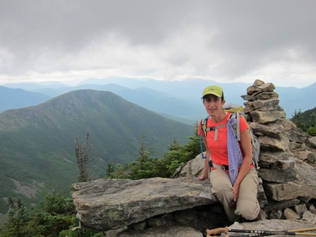
We’d heard the views were great, so we headed south on the Bondcliff trail, forming an inverted Y” from our west-east traverse from the huts. After the main branch of 0.8 miles toward West Bond, we took a spur toward West Bond – here looking eastward from West Bond toward Bondcliff – the views really were spectacular, even with the cloud cover. It must be just amazing on a clear day!
The weather was starting to deteriorate, so we didn’t spend nearly the time we could have on West Bond and since we still had the other spur out to Bondcliff, we we decided to leave our packs in the woods and go “bag Bondcliff”. It wasn’t quite as easy as we thought, but still alittle refreshing to not have our packs with us.
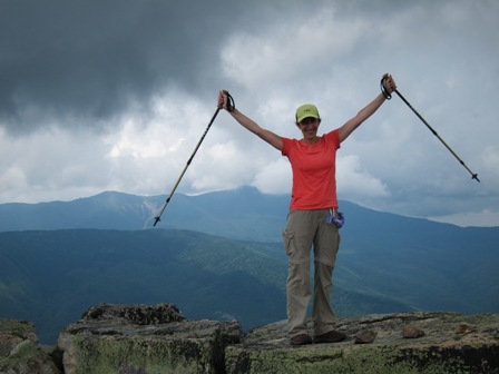
We really needed to keep moving pretty quickly, though we couldn’t help stop and give a brief “woo-hoo” for each of the summits we were adding to our growing list of 4000 footers – West Bond, Bondcliff and Mt. Bond. Clearly though, the clouds were moving in and growing more ominous as the day wore on…
Back over Mt. Bond, and retracing our steps to Mt Guyot, we met up with our Bond side-trip departure point just as we started getting our first few rain drops. Out came the pack covers and our rain jackets – the rain was fairly steady from then on.
From the junction of Bondcliff and the Twinway, it was only 2.8 miles to go to the hut. Not too bad with the rain, but it was the rumble of thunder that had us worried. The cloud cover was also pretty low, so visibility wasn’t great. on the “twinway”. We made South Twin and it was only 0.8 to go to the hut (though 1200′ elevation loss!). The wet rocks slowed us down quite a bit, never really knowing whether the next foot-fall would be slippery or not. The hut was a welcome sight, indeed!
We finally rolled into the about 4:30 in the afternoon – a very loooonng day, but very satisfying! Six peaks on our list of 48, 13 miles, through some rain. It was great to be there – along with lots of other very wet people – including a few backpackers and the “NoBo’s” and “SoBo’s” (those few who are on a quest for the entire Appalachian Trail – heading north-bound or south-bound). Not quite as intrepid (we like to think of ourselves as fortunate to be able to afford the slightly pricey huts) we were fortunately NOT the last ones to arrive at the hut that afternoon, so we were able to get beds together. It took some time for us to dry out, raisin fingers – but dry out we did. Can’t say the same for our clothes and packs and all. Though, the ziploc baggies kept our other clothes dry, so we had things to change into. We were treated to a turkey dinner, and a quiet night (with NO critters!).
Sunday morning broke with no rain, though again, some cloud cover, and a repeat of the weather report. Unsettled, with showers and t-storms predicted for later in the day. Jeanne was feeling particularly energetic in the morning and suggested we bag Galehead – which was to be our 6th 4000 footer for this weekend.
And that we did – right after breakfast and pack free, we left the hut at 8am for the 1/2 mile to Galehead summit. As it turned out a great warmup for our planned trip back to the car – 4.6 miles from the hut, heading west on Garfield Ridge trail for 0.6 miles, then heading north on Gale River trail for 4.0 miles back to the car. While the first 1/2 mile or so of this trail was somewhat steep (not quite as steep as the trail from South Twin, and still nothing like Ammonoosuc Ravine at Mt. Washington), the last 3+ miles were a gradual grade downward. A very “easy” end to a big weekend.
Next up, Switzerland and the Jungfrau region!