Mt. Mansfield, the last of our 4000 footers in Vermont. We’d planned this one back in the early spring, thinking of taking advantage of foliage season in early October. As is always the case, you don’t really know what the weather will bring – it’d been a hot, though dry, summer which meant that foliage, what little there might be because of the draught, was shaping up to be late.
Regardless, we had a cute little 1-bedroom condo for 2 nights on the first weekend in October, and headed off Friday evening, arriving in the dark. The weather had been variable all week; Saturday was no exception – Mansfield was in and out of the clouds, though it was just overcast on the mountain road in Stowe, VT; the day’s temperature was comfortable.
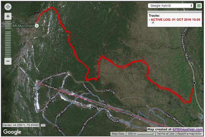
We chosen to follow the Long Trail, south from the roadway, to the Mansfield summit – also known as “The Chin” (for the ridgeline profile in the shape of a face). The trailhead was on the mountain road, just beyond Stowe ski area. A very helpful VT ranger at the ranger station on the road, told us it was just 1/2 mile up the road; easy to find because of the numerous cars there, even at 9:30. The trail itself started in the woods, with a sign-in kiosk complete with trail map. The round trip distance was 4.8 miles, an elevation gain of 2800 feet, and a book time just under 4 hours. Our past experience had told us that we consistently beat book time, but we’ve also learned that each hike is unique.
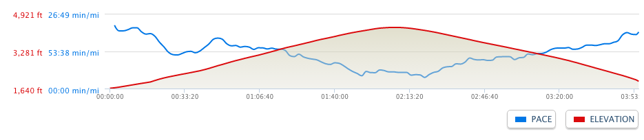
Leaving the sign-in kiosk, the trail immediately gained elevation. Nothing too strenuous, but definitely gaining elevation. The footing was good, so it was fairly easy going, though a very steady uphill, almost as if we were on a stair climber. Poles were definitely a big help. Mostly in the trees, there wasn’t much in the way of views of the Stowe valley area, though we did get a brief glimpse at one point.
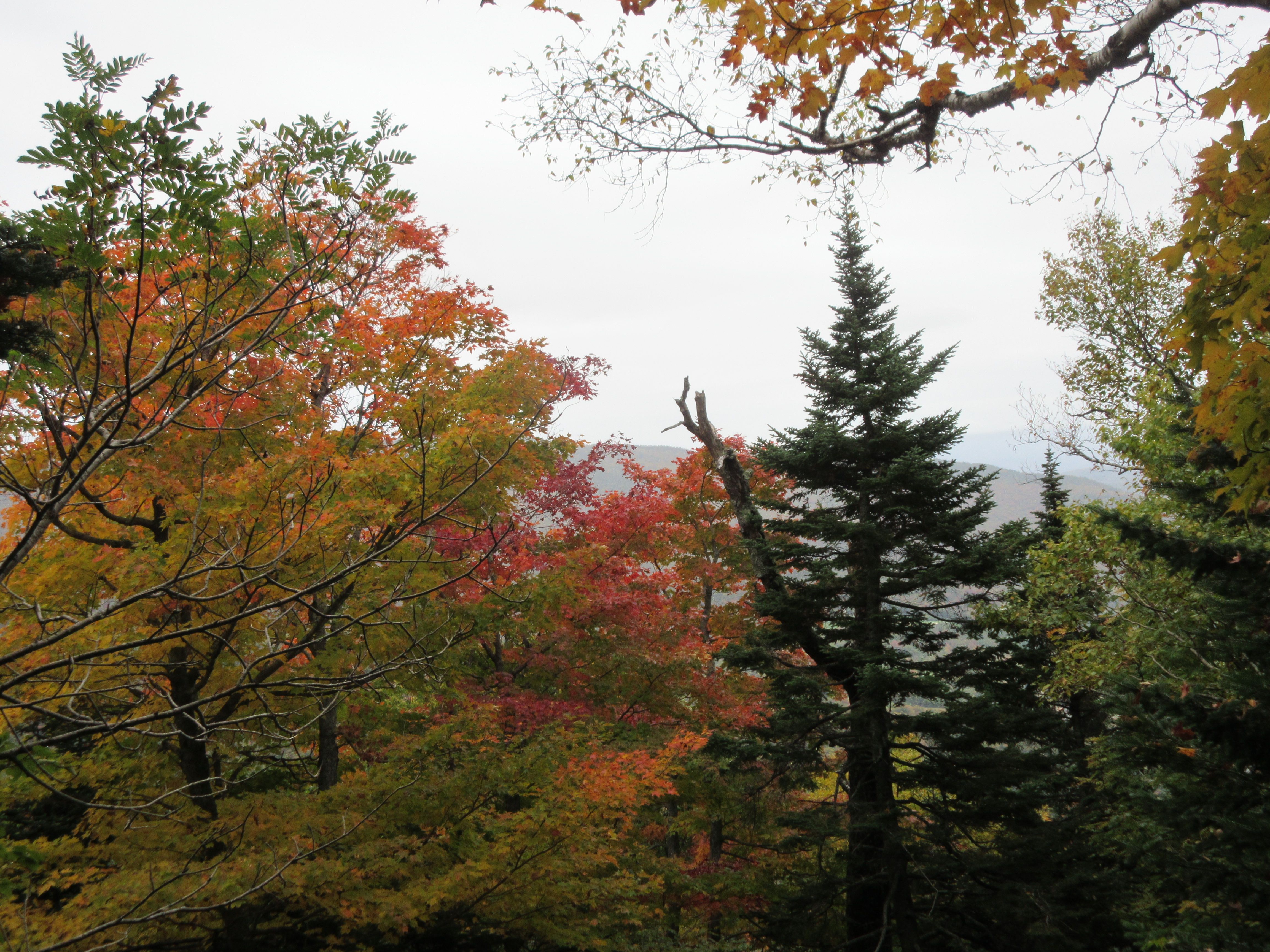
Shortly after this and as we continued to gain elevation, we began to enter the clouds – and with it, a bit of fog/wetness… Nothing much, but we could tell we were in the clouds. As we did so, the forestation was also changing – from the typical hardwoods, to stumpy pines, and eventually to alpine zone. Signage on the route told us we had only a short distance remaining to the summit, only .3 mi, but by this time, the wind had also picked up a bit, so both wind-chill and drizzle were creating a not so pleasant combination, but that’s the thing about hiking the peaks – the weather can play a big role in the experience. Today was no exception.
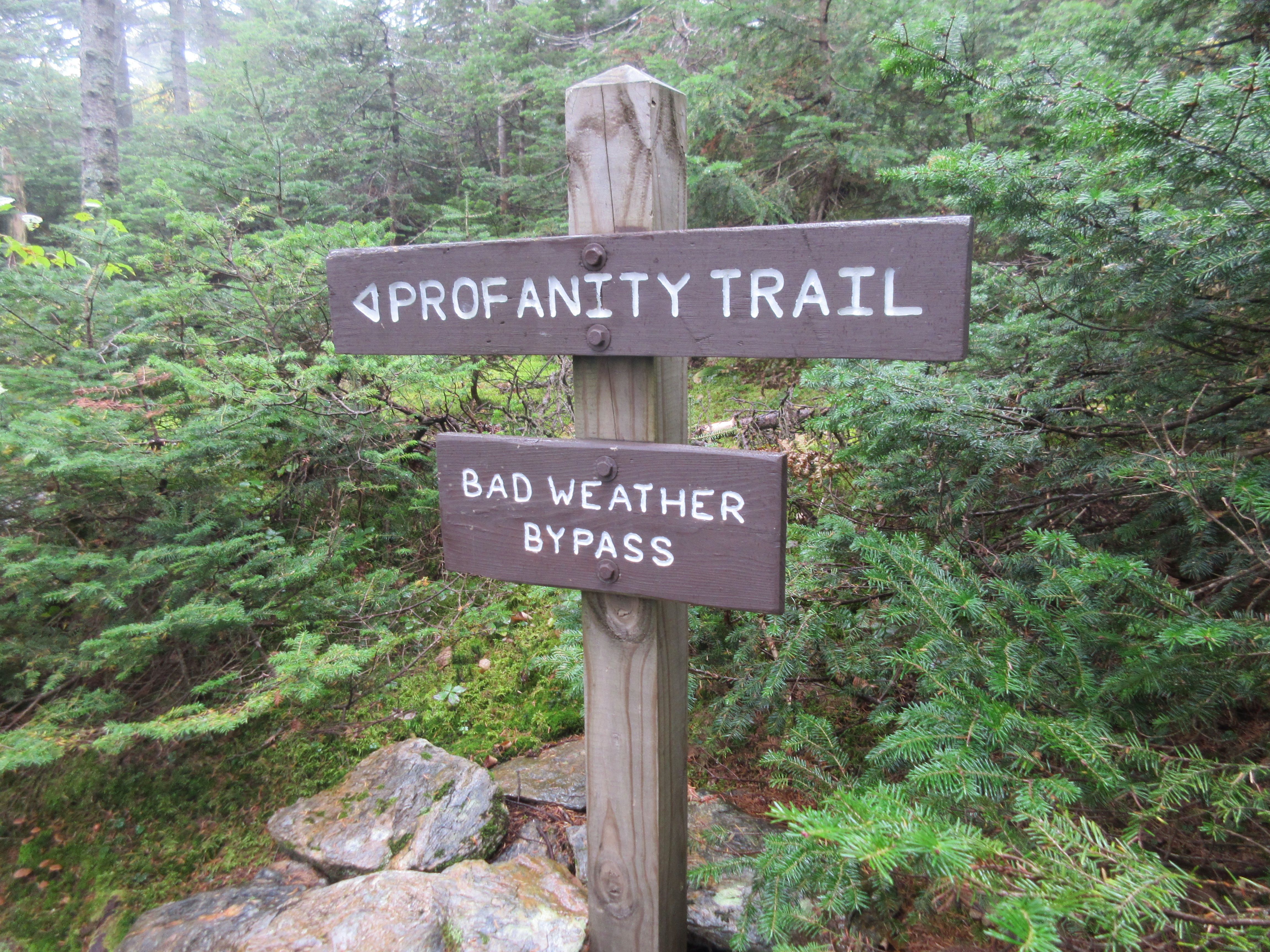
The last quarter mile to the summit was difficult – no question. In good weather, many posts talk about the difficulty. There is some rock scrambling, and even a bit of a chimney to crawl up a section… In our deteriorating weather, it was definitely unpleasant. Fortunately, even with wet rocks, the footing was good. Even so, it made us finally understand (or ascribe in our heads) the origin of the trail cutoff we’d seen further down the trail, just before entering the alpine zone, there definitely were some mutterings of profanities!
But when we finally DID reach the summit – or at least, what we thought was the summit, because it was completely enveloped in the clouds/fog, with a 50+ mph steady wind, it was bordering on risky… No cairns to speak of – the trail could easily be missed, so it was a quick kiss for our 54th 4000′ summit, and a rapid descent down to gain the shelter of the treeline.
In the end, we did just about book time, slightly under 4 hours. Overall, it was a pleasant hike, and I imagine in good weather, it’s got some great views from the summit. Maybe save that one for another day, pick up the Long trail from the south, and head north to Mansfield. So many mountains, so little time!