#55 and #56
We’d planned a full week of hiking in the Carrabassett Valley, even before the winter season had set in on Sugarloaf, the centerpiece ski resort in the region. Our plan was to combine our annual AMC volunteer training at the Gorman-Chairback facility with a week in the valley, peakbagging another 10 of the 4000 footers – bringing us closer to our goal to complete the NE 67.
Forget the usual weather anticipation – it always occupies our thoughts in the week leading up to our hiking. The wet Boston spring certainly didn’t bode well, but the weather gods smiled on us. After a soggy drive to our AMC training, the weather gradually cleared, with very warm sunny days.
The training behind us, we headed to Carrabassett Valley on Sunday afternoon, settled into our AirBnB condo (yes, we like a hot shower at the end of the day in the woods) and talked of our strategy for the week. We’d planned five days of hiking for the week:
| Peaks | Miles |
|---|---|
| Bigelow West/Avery Peak | 10.6 |
| Mt Redington and the Crockers | 8.6 |
| Saddleback, and The Horns | 6.8 |
| Sugarloaf/Spaulding | 10 |
| Mt Abraham | 8 |
Bigelow West and Bigelow Avery was the longest hike on paper – 10.6 miles via the Fire Warden’s Trail. Basically a straight climb up to the Appalachian Trail, then a brief left, then right on the AT, and return the way we came. With the weather looking good for the week, we planned to tackle the longest first.
Note to self – it seemed much of the north country tends to hibernate during black fly season – roughly Mother’s day to Father’s day. And with good reason – after being in the woods at AMC’s Gorman-Chairback, we got a good taste of how voracious the little suckers can be (easily dozens circling at any one time!). Some of the local restaurants, etc. were shut down, so finding grub became a bit of a challenge.

As always, we were up early and at the Fire Warden’s trailhead off Stratton Brook Pond Rd shortly before 9am. As we’ve been accustomed, trailheads are often hidden far off the main roads. Following Stratton Pond Road for roughly a mile, the dirt road ended with a small parking area and a trailhead sign.
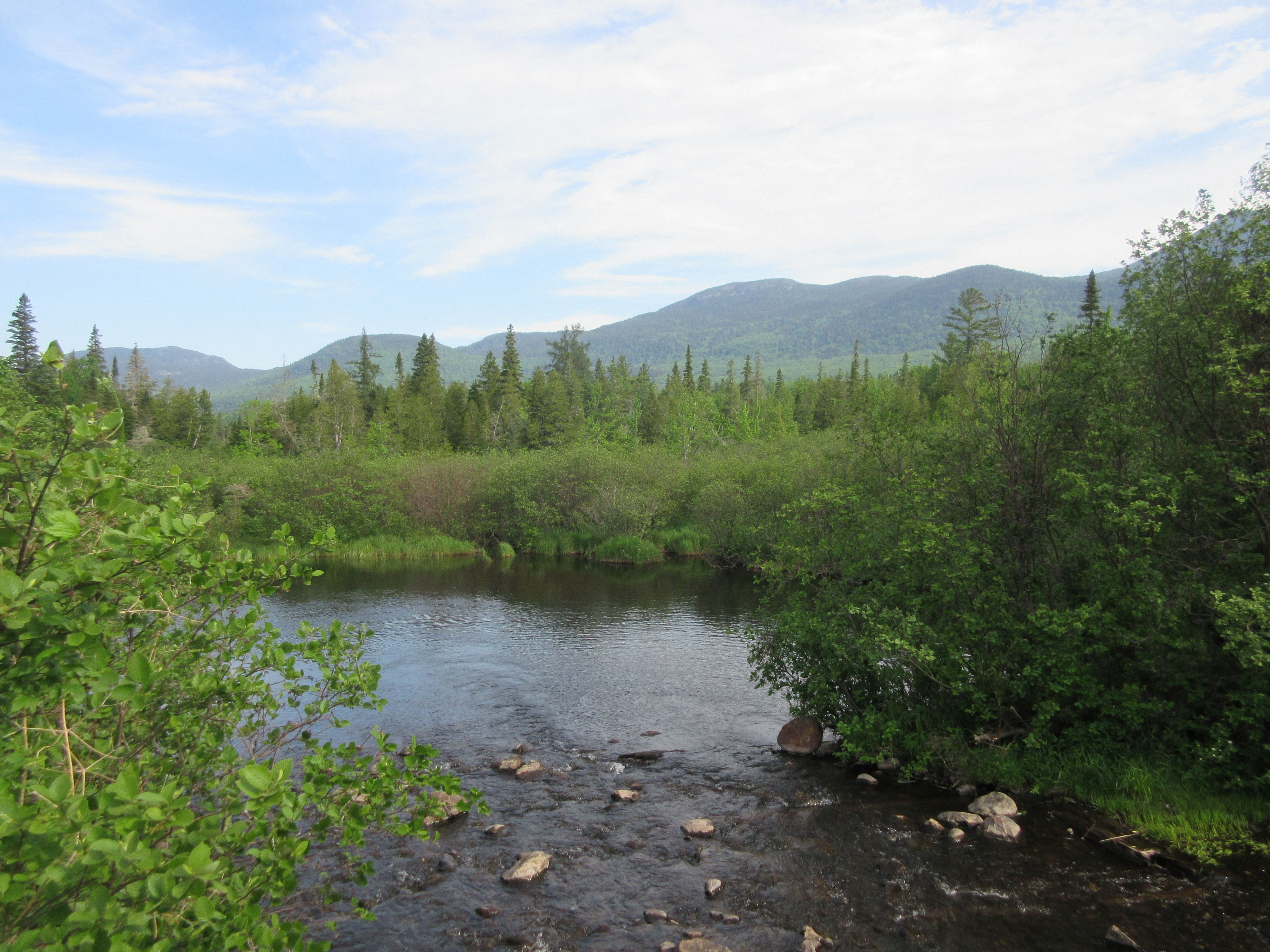
Gearing up, and not forgetting the excessive amounts of bug spray (it was black fly season!) we headed into the woods shortly before 9, following a logging road for a piece, and making some excellent time. If we’d had a high clearance 4-wheel drive, we could have made it further on the Fire Warden’s trail – there’s probably another 1/2 mile before the trail ends at a bridge over a stream crossing. For us, the walk was a good warm up, plus it followed a lake, providing some stunning views of the lake and surrounding mountains.
Not long after crossing the bridge over the stream, the trail turned into the woods, heading further northward and began a gradual ascent toward the AT, following a blue-blazed trail (courtesy of the Maine Appalachian Trail Conservancy). Passing Horns Pond trail – closed for some reason – the trail continued a steady climb upward. No scrambles along the way, but definitely some rocks and boulders.
About 2 miles past the Horns Pond junction, we came to the Moose Falls campsite. A tent platform, a privy, and some confusing trail information. Toward the left, there was a blue blaze painted on a large boulder, though attempting to follow that lead nowhere. Retracing our steps, we eventually found the trail continuation uphill from the tent platform.
Continuing on, we shortly came to the junction with the AT and the choice of whether to head south to Bigelow or north to Avery. Avery it was, so after a brief food break, a quick .4 miles above treeline to the Bigelow Avery summit and some of our first taste of the amazing views! By this time, the temperature was easily in the 80s, with quite a bit of humidity, so there was a bit of haze, but the visibility was still amazing.
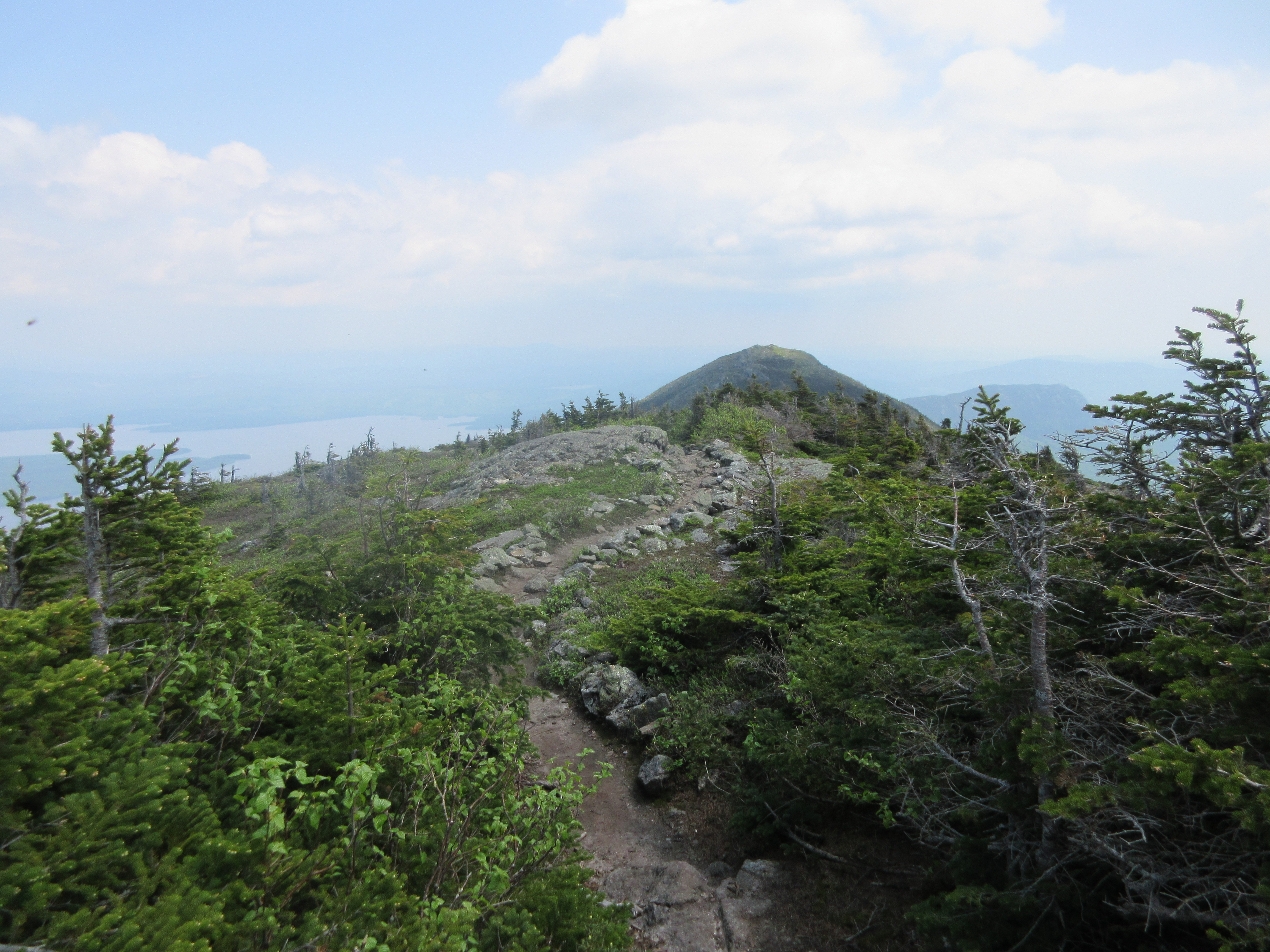
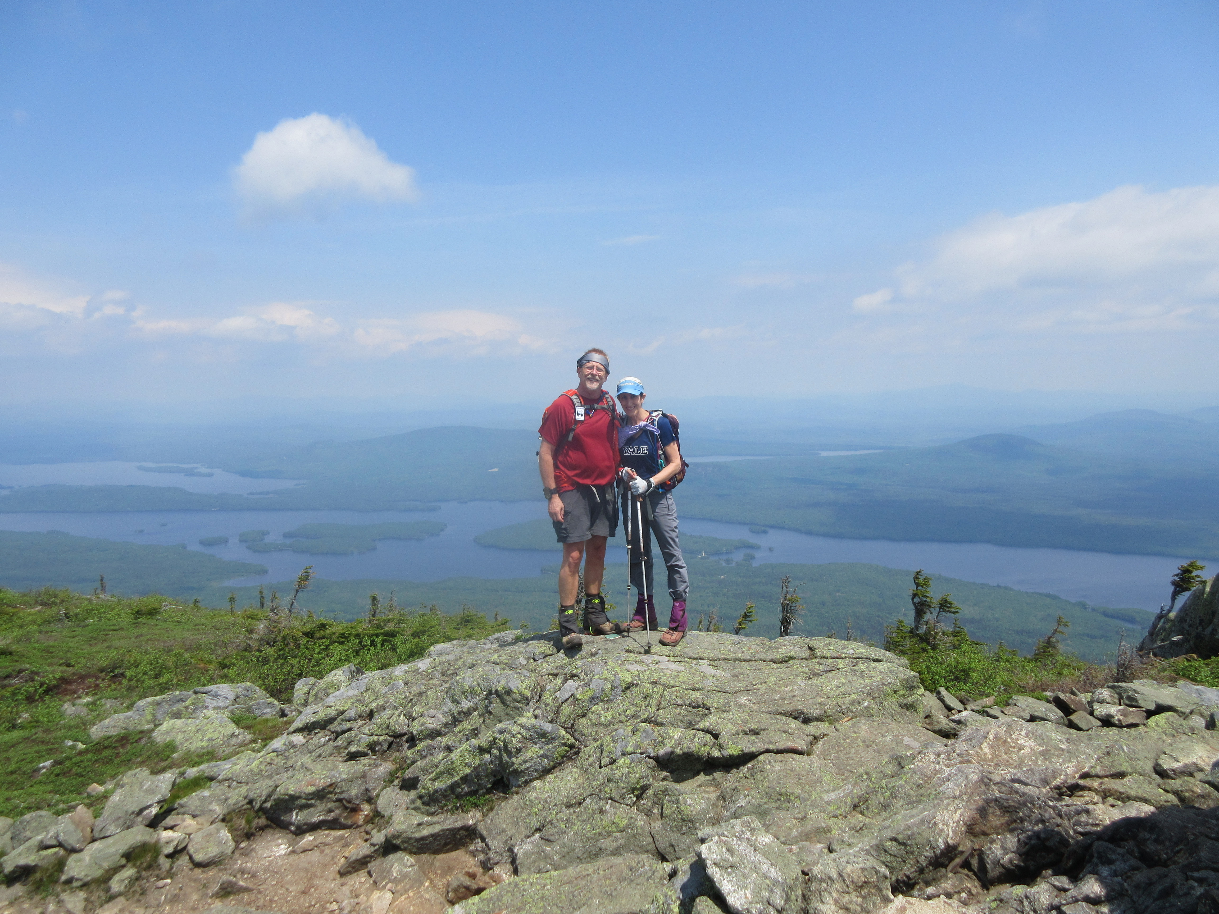
360 degree views all around, an amazing look at Flagstaff lake – a man made lake supplying both water and hydroelectric power to the area.
As the first day of our multi-day peak bagging, this hike was a real treat – 4 miles of not too strenuous hiking to summits with 360 degree views – probably one of our best hikes. Enough of the views, we began our descent, passing a group of 6 hikers on their way to the summit, getting a bit of a late start…
All in all, a great way to start our week! Read about our next day hiking Redington and the Crockers