#61, #62, and #63
On our return from Saddleback and the Horn, we stopped at the parking area where the AT crosses Rt 27 just north of the Sugarloaf access road. The weather was starting to look bleak for Friday – it being Wednesday, we thought we might need to adjust our plans a bit… The map at the junction helped our discussion, though the swarms of black flies might have hastened our decisions!
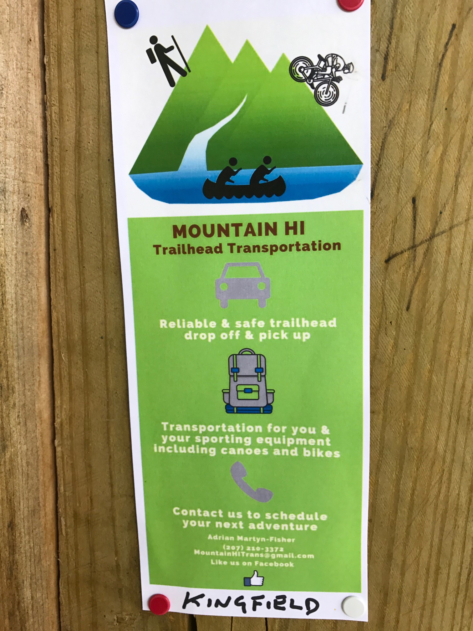
The original plan had been to do Spaulding and Sugarloaf on Thursday, though with the Caribou Pond road closure, that put a big damper on that plan (the primary access being from Caribou Pond)… HOWEVER, while looking at options, we (Jeanne!) noticed a flyer attached to the map kiosk for a hiker’s trailhead transportation – we’d talked a bit about maybe combining Abraham with Spaulding and Sugarloaf – that could really help things out – enabling us to do a point-to-point – spot a car at Abraham, and do the traverse to Sugarloaf.
A brief call to Adrian and we had a plan – pick us up at Sugarloaf mountain resort at 8:30am on Thursday, drop us at the Mt Abram trailhead and away we go.
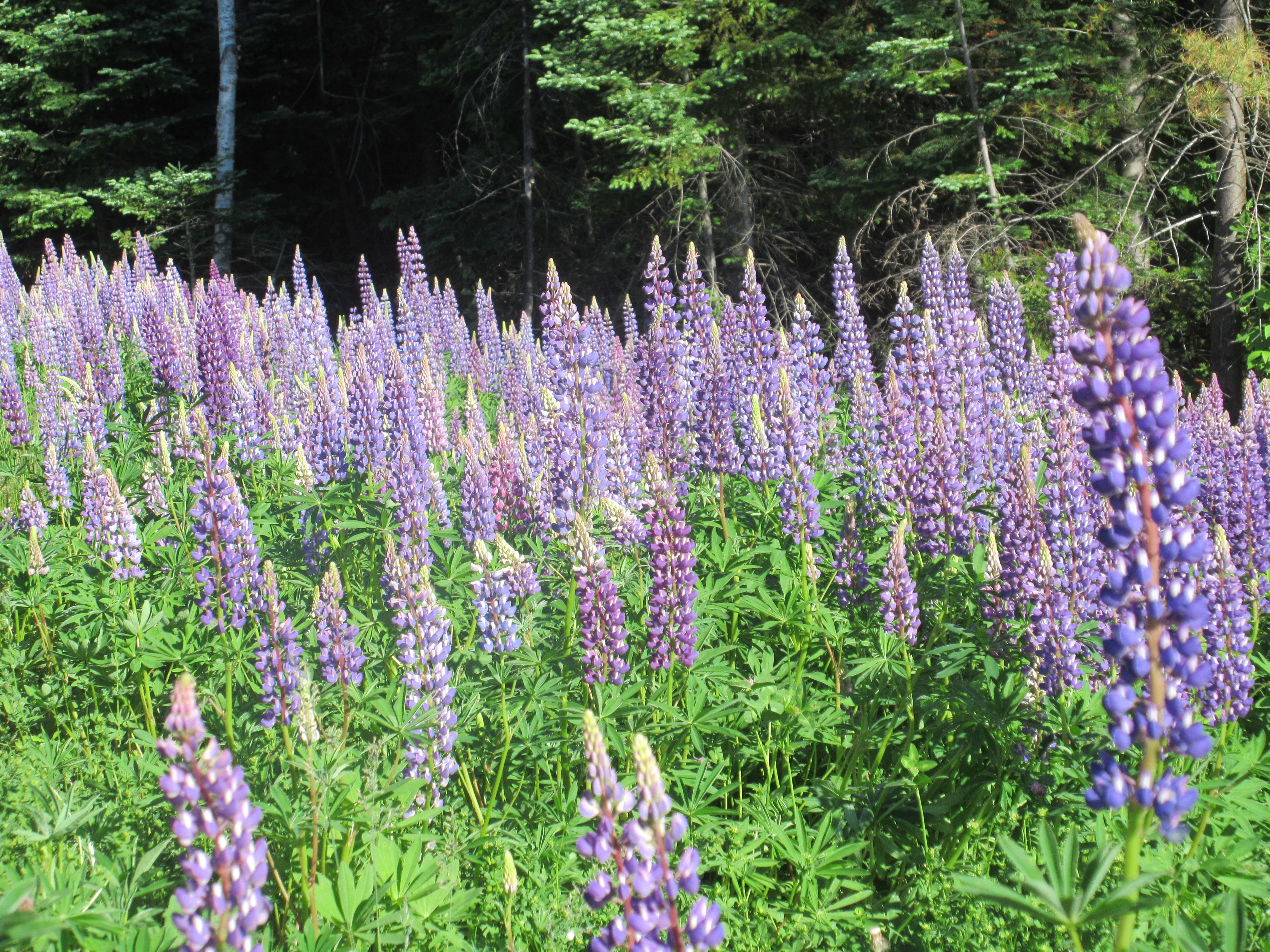
Heading out a bit early, we grabbed a quick photo opportunity with a field of Lupines. In full bloom, we drove by many fields – and had even walked through a field on Saddleback a few days prior. Just beautiful!
And good thing we didn’t try to find that trailhead ourselves! From Kingfield, take W. Kingfield road to the end, the road becomes a dirt road, then logging road, with various offshoots. Not the kind of area one wants to get lost in… As it happens, Adrian lives on that road, so he knew precisely where the trailhead was!
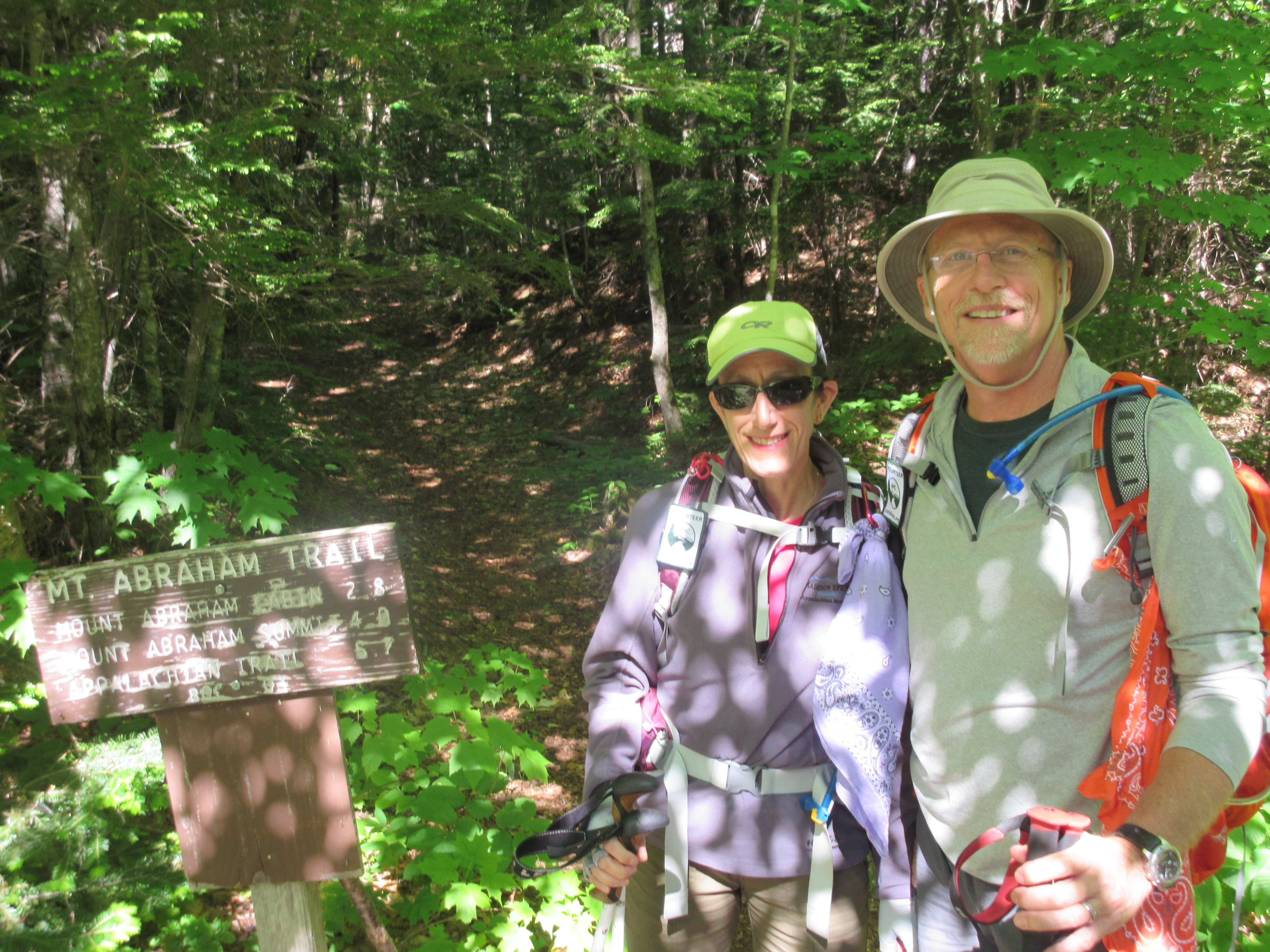
Shortly after 9am, we’re dropped at the trailhead, but not before a quick group photo at the trailhead. Adrian makes a U-turn and here we are again, in the woods. But yet another beautiful day, weather wise, so we shove off, and begin the gradual ascent.
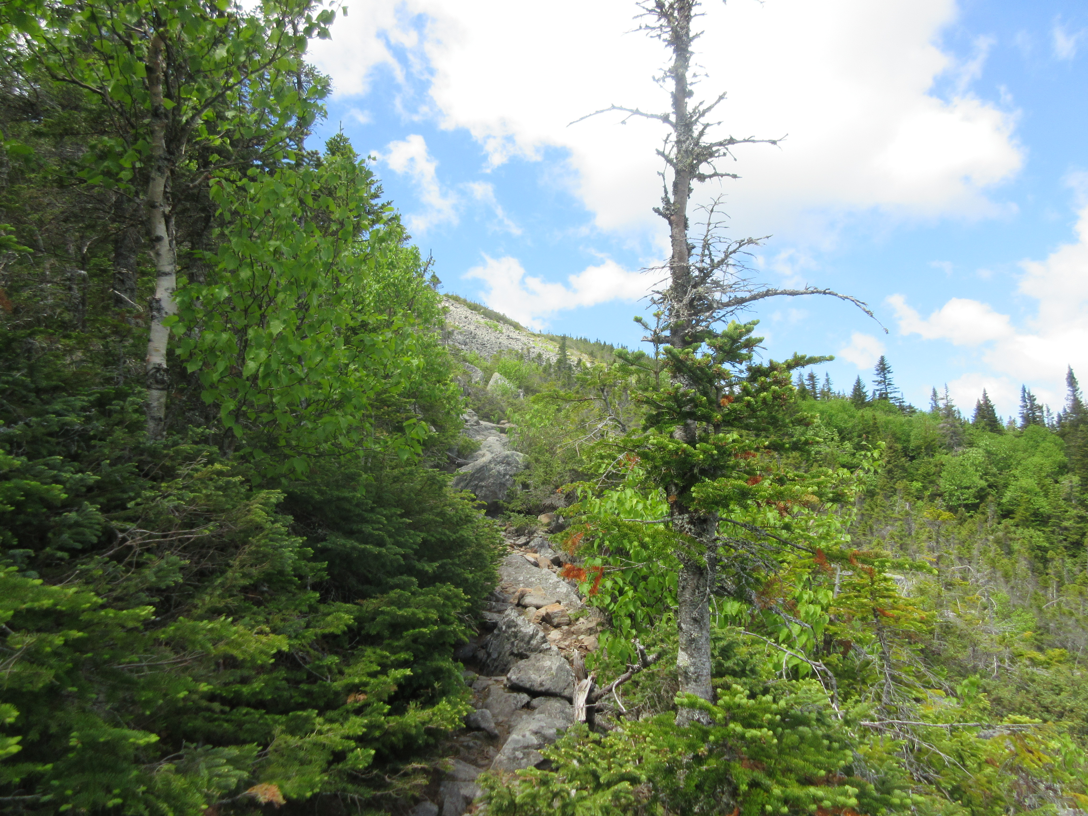
About 2 miles in, the grade gradually became steeper and more rocky and about 3-1/2 miles, we came out of the trees, but came to the rock field – just a massive collection of rocks/boulders – not unlike Mts Adams or Washington in New Hampshire. Definitely steep, and fortunately, plenty of well-marked cairns – because otherwise, it’s all just a bunch of rocks – no path!
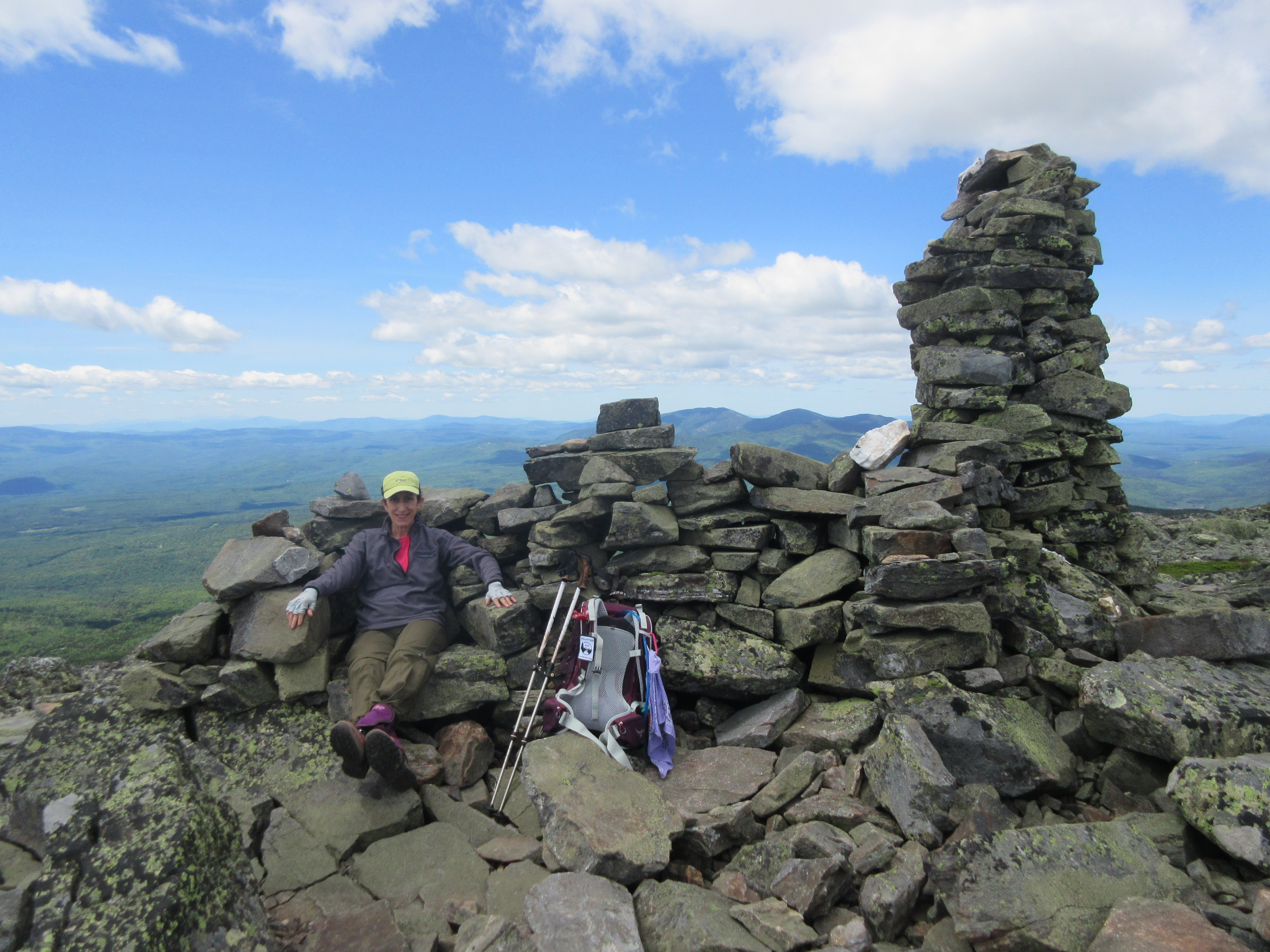
But with rocks, the footing is almost always good, so continuing upward, we eventually came to the summit – where there’s a rock shed, with a roof from the old fire tower, which is toppled over and beginning to rust…
After a bit of time for some food – remembering to eat and hydrate after our tough day on Tuesday, we began to search for the trail toward Spaulding (remember, it’s all just rocks – hard to see anything), we walked over to the other (false) summit – maybe 30 yards in the distance. Jeanne found a very comfortable restaurant (rock) chair to enjoy her food!
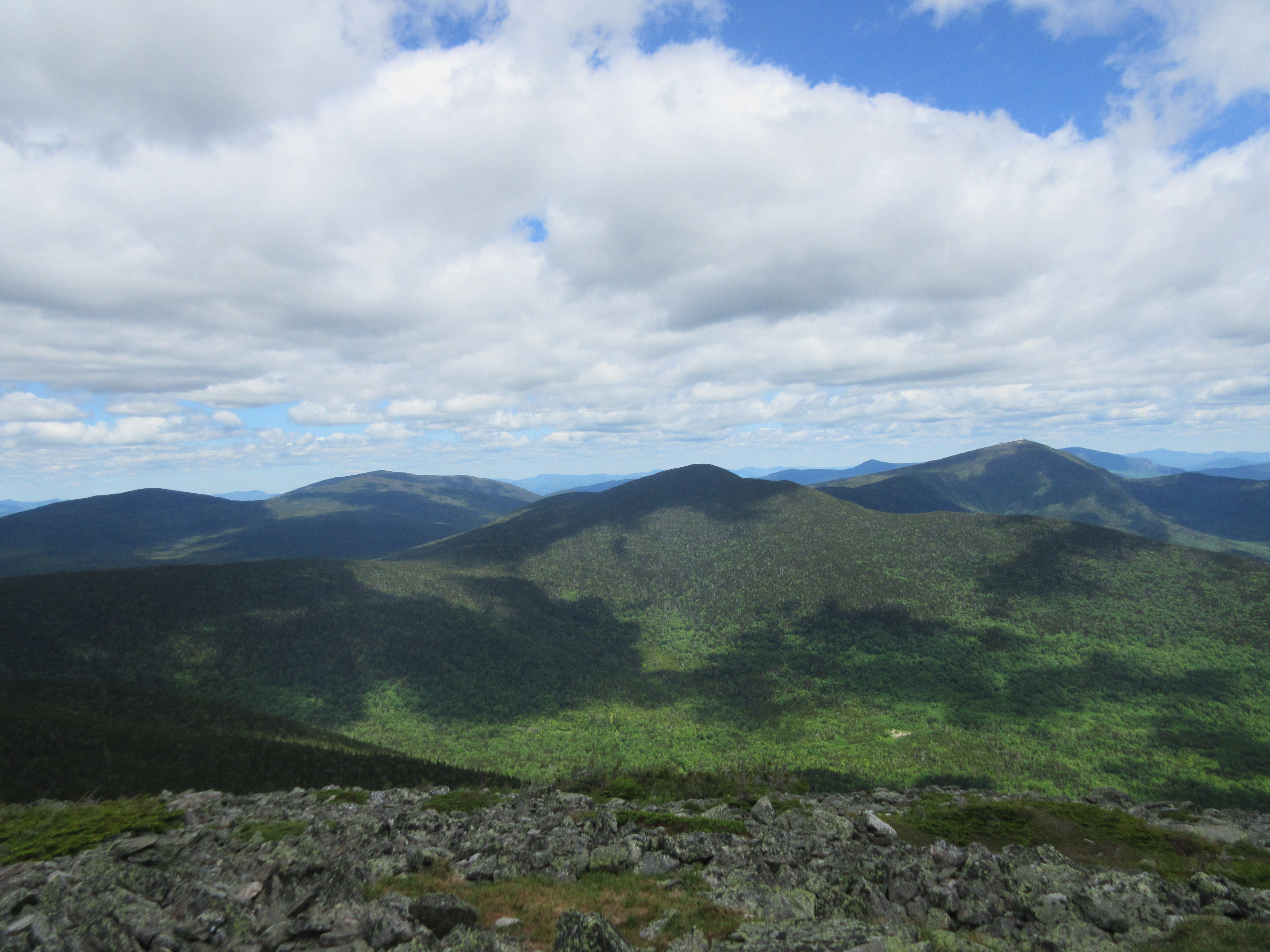
Circling the summit, we eventually found the Abraham Side trail – which would lead us to the Appalachian trail, 1.7 miles away. It was downhill for a bit, but quickly off the rock pile, which is always easier on the feet. But not before some more pictures of the amazing views (this time, toward our Sugarloaf destination!
There’s a certain amount of comfort getting back on the Appalachian trail – the trail is always well-marked, and you’re almost guaranteed to see someone.
For us, being up in the area for a few days, we’d run into some of the same hikers on more than one occasion. This time, it was a woman who was section hiking in the area. She was reposing on the Spaulding Mountain summit, nearly completely in the trees and accessible using a 150 yard spur off the AT. I think we surprised her a bit. We chatted for a bit, then headed on our way, next stop, Sugarloaf.
One of the things that’s always surprising – while many of these summits for Ridges, and we’d often speak of Ridge walks – very few ridge walks don’t involve some elevation changes. Redington from Crocker dipped 700 feet between summits. This one, didn’t involve much elevation change – at least from Spaulding to the junction with the Sugarloaf trail, but from that junction, we picked up at least 600 feet. I know, that’s why they’re called mountains… just sayin’
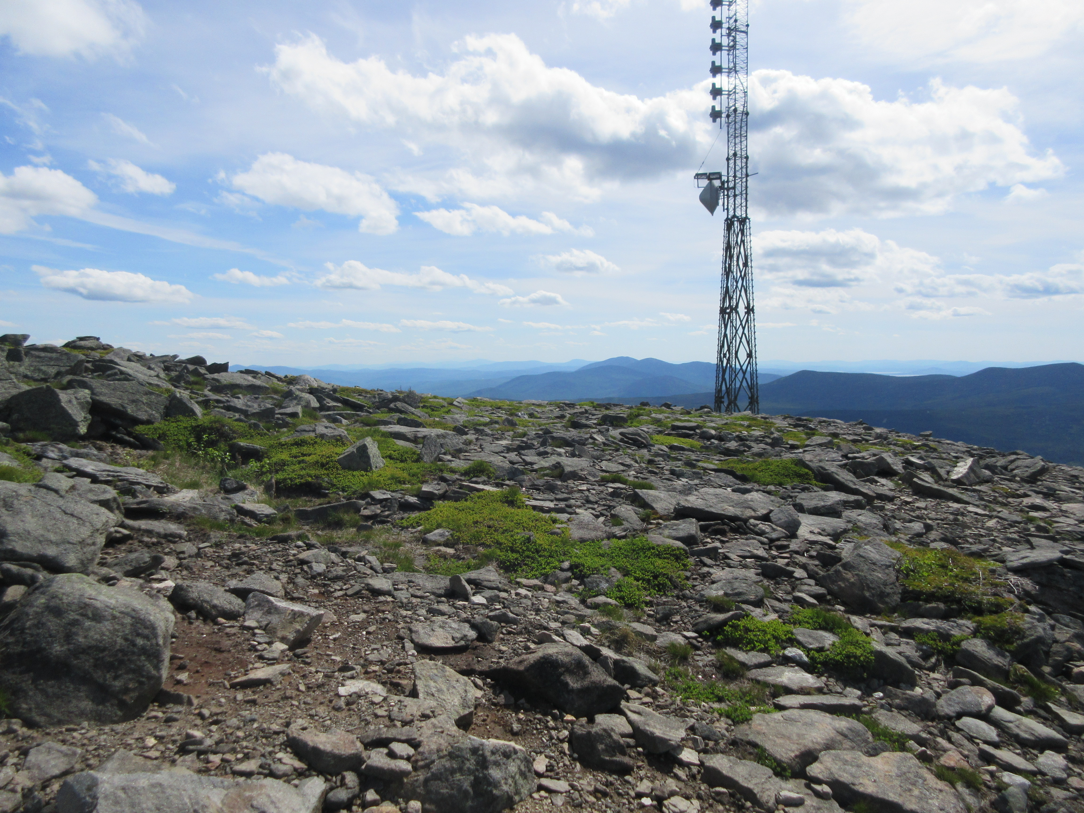
With its radio towers, the Sugarloaf summit, was visible from every peak we’d visited with a view this week, so it always seemed like it was far in the distance. Today was no exception, so it was certainly a welcome site to break out of the woods and see the towers up close (no, the towers themselves up-close are fairly ugly) – it was more the thought that we had finally arrived at the summit. Appearing very much like Mt. Washington – loose rock everywhere, and the ugly towers… Hopefully, Katahdin isn’t the same.
It was slightly later in the day than we’d hoped – but we still had plenty of daylight, and the thought of our car being at the bottom of the hill was tantalizing! So again, a short walk around – though there’s really not much to see – mainly to get our bearings, then we started the long walk down the ski trails, first following the Timberline trail, then transitioning to the Tote Road trail.
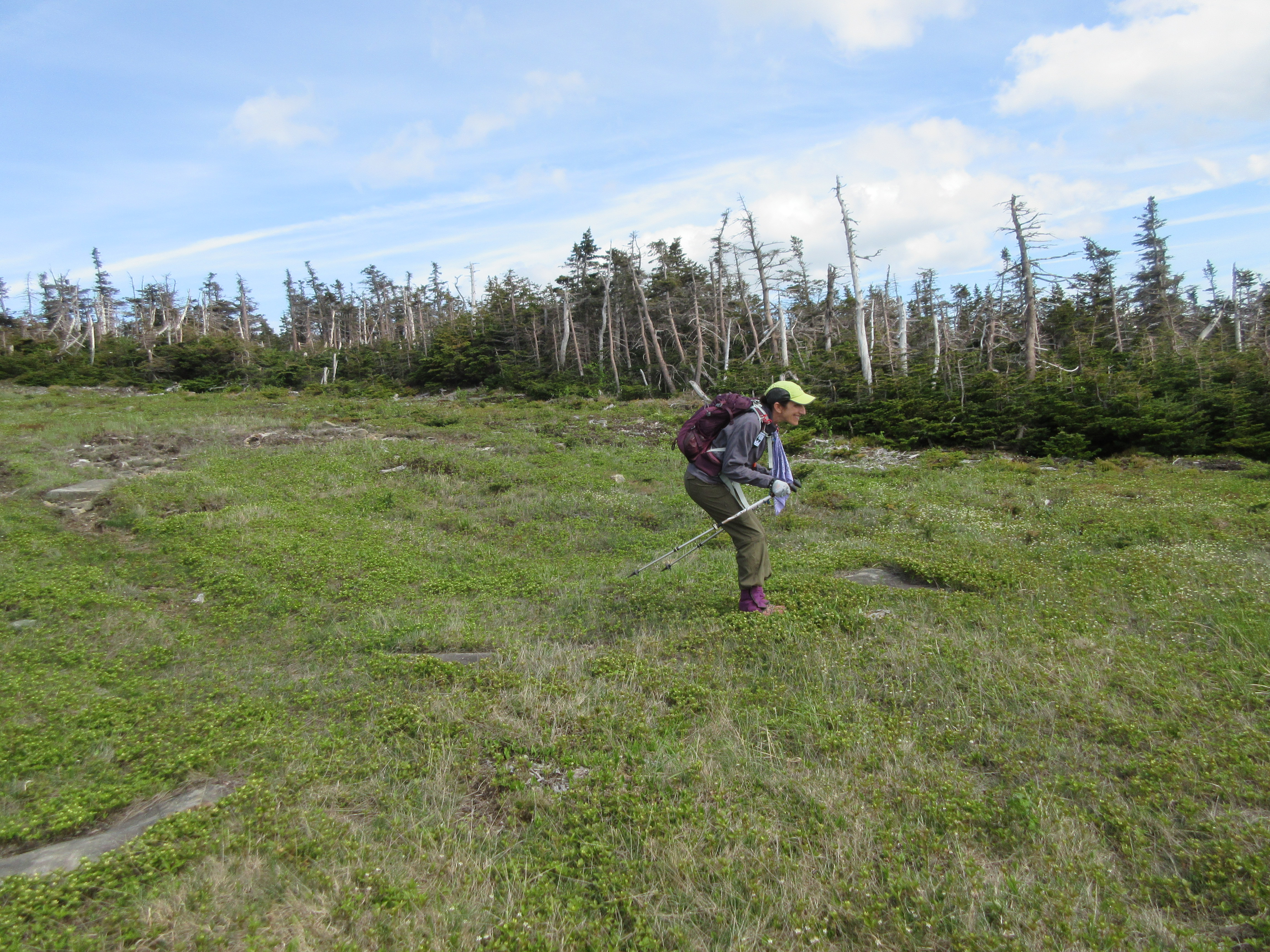
Unlike Saddleback, which had a herd path on the ski trail – no such thing here at the Loaf. We had to be careful with our footing – cautioning against ‘sink holes’ – small holes in the terrain caused by the boulders beneath the thin soil skin and trying to find paths through the grasses on our way down. We were still in good spirits – Jeanne even got in a cameo of her ‘skiing’ on Sugarloaf – probably the only photo of its kind in existence!
As before, the long downhill – this time 2 miles worth – definitely did a number on the quads. We were both VERY tired when we finally arrived at the Sugarloaf Mountain resort and our car. It had been a very long day, but a good one – definitely some great views, nice chats with some fellow hikers, and three more peaks on the list of 67!
In the end, it had been a long week – we accomplished most of what we’d set out, saw some amazing scenery, had some good work outs, and spent more time with the bugs than we would have liked. All in all, it was a great week!
| Peaks | Trails | Distance(mi) | Elevationgain |
|---|---|---|---|
| Bigelow West/Avery Peak | Fire Warden’s Trail Appalachian Trail | 9.8 | 3333ft |
| Mt Redington and the Crockers | Appalachian Trail Herd Path to Redington | 12.3 | 3622ft |
| Saddleback, and The Horns | Ski trails (Gray Ghost, Tri-color) Appalachian Trail | 6.5 | 2900ft |
| Abraham/Sugarloaf/Spaulding | Mt. Abram trail Abraham Side Trail Appalachian Trail Sugarloaf Side Trail Ski trails | 12.7 | 4974ft |
| Totals | 41.3 miles | 14,829 ft |
and yes, we finally got to Crocker, a few weeks later – returning to the Carrabassett Valley over the 4th of July weekend.