This day was something of a ‘transitional’ day in our Zion/Sedona itinerary. We were traveling southward from Zion, but a single drive through to Sedona would have been nearly a full day driving – nearly 300 miles. Sitting in a car all day didn’t sound appealing – plus, there were trails along the way – so we’d decided on a day-hike and a stop-over in Page, AZ – roughly the halfway point.
Between Zion and Page are a series of slot canyons – so called because, while they’re a canyon, they’re typically very narrow, on the order of 3-5 feet, though depths could range 50-100 feet! Many of the slots in Southern UT/Northern AZ are on native american lands, requiring special permits or are guide-only. One we found – Buckskin Gulch – wasn’t controlled in that way, and was on the way to Page, AZ – perfect!
Leaving Zion, we enjoyed our last look at the beauty, and settled in for the roughly 90 mile trip to the trailhead turnoff – House Rock Valley Road. And with the monotony of the highway, we blew right by the turnoff – hardly more than a dirt road. Fortunately, we had an Explorer – for the 5 mile dirt road to the Buckskin trailhead, which was little more than a parking area amongst the tumble weeds (yes, tumble weeds).
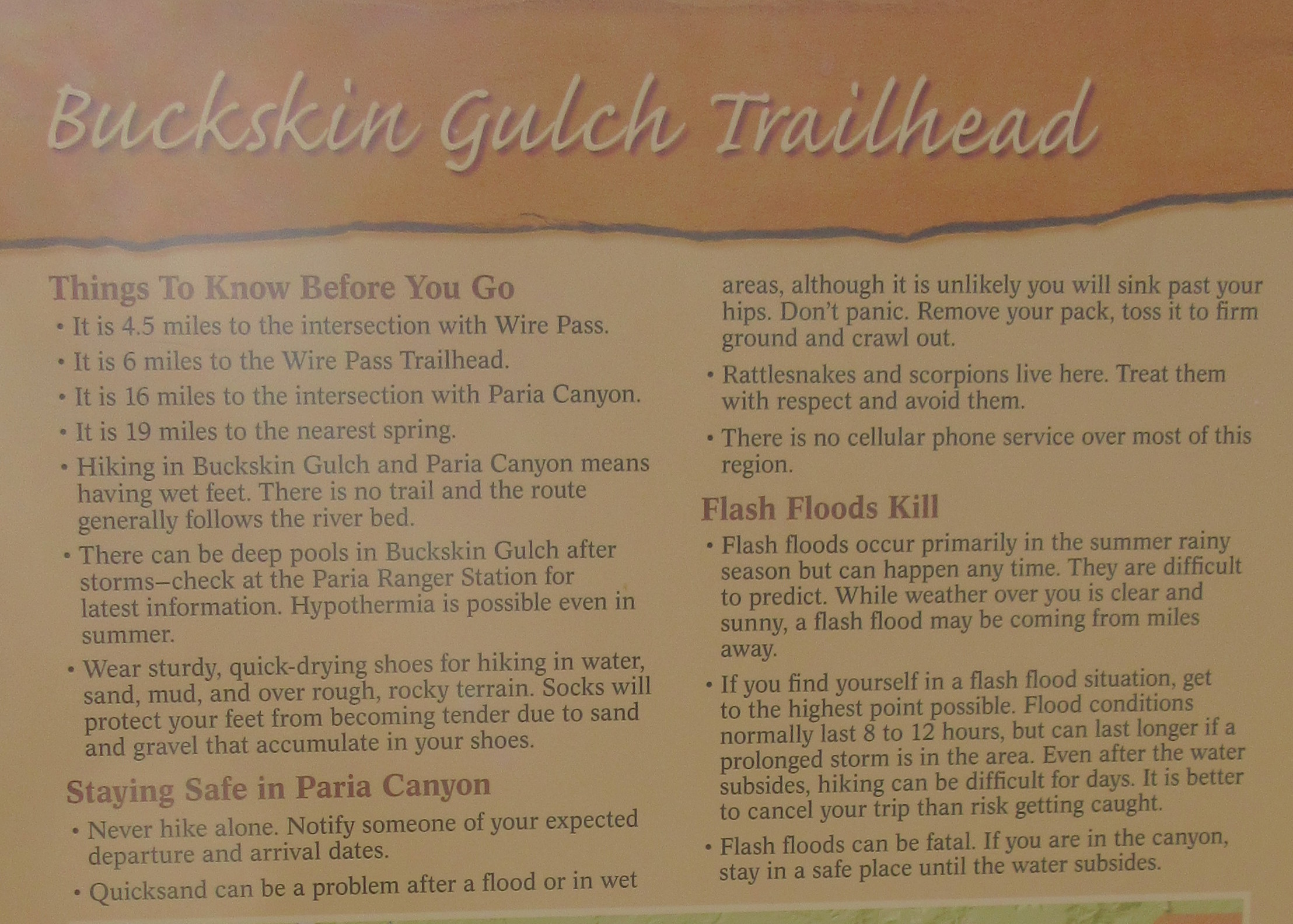
We opted for the Buckskin gulch trailhead, rather than the more popular, Wire Pass trailhead, due both to the rough going on the dirt road, and being low on gas (not a good situation out there). Though after gearing up, and reading the signage (see the photo to the right), this didn’t sound like any sort of picnic – very reminiscent of the signage on
Mt. Washington warning of death by exposure in bad weather).


The going was relatively easy, mostly a dry river bed, but not very interesting. Some interesting rock formations along the way, but otherwise, not interesting. We didn’t spot another soul for over an hour+, which made it slightly creepy – a very real reminder that we were out in the middle of nowhere, 5 miles off the highway, another 3+ miles of hiking, and nothing.
Soon though, we reached the first slots of the Paria river (the river bed we were on) – definitely a unique experience. While the walls weren’t particularly high, the narrowness caused a nearly claustrophobic sense. And it was hard to not imagine the chaos that could occur during a flash flood – the water has nowhere to go, especially with all of the debris that would be out in front.
Definitely an interesting experience – vastly different from the mountains of New Hampshire which we’re far more accustomed. We were “in the slot” for perhaps 10-15 minutes, before breaking out into the junction with Wire Pass trail, an open area at the intersection of two slots; punctuated by nearly shear walls on all sides, though easily 100+ yards across.

Some views of the Buckskin Gulch Slot:


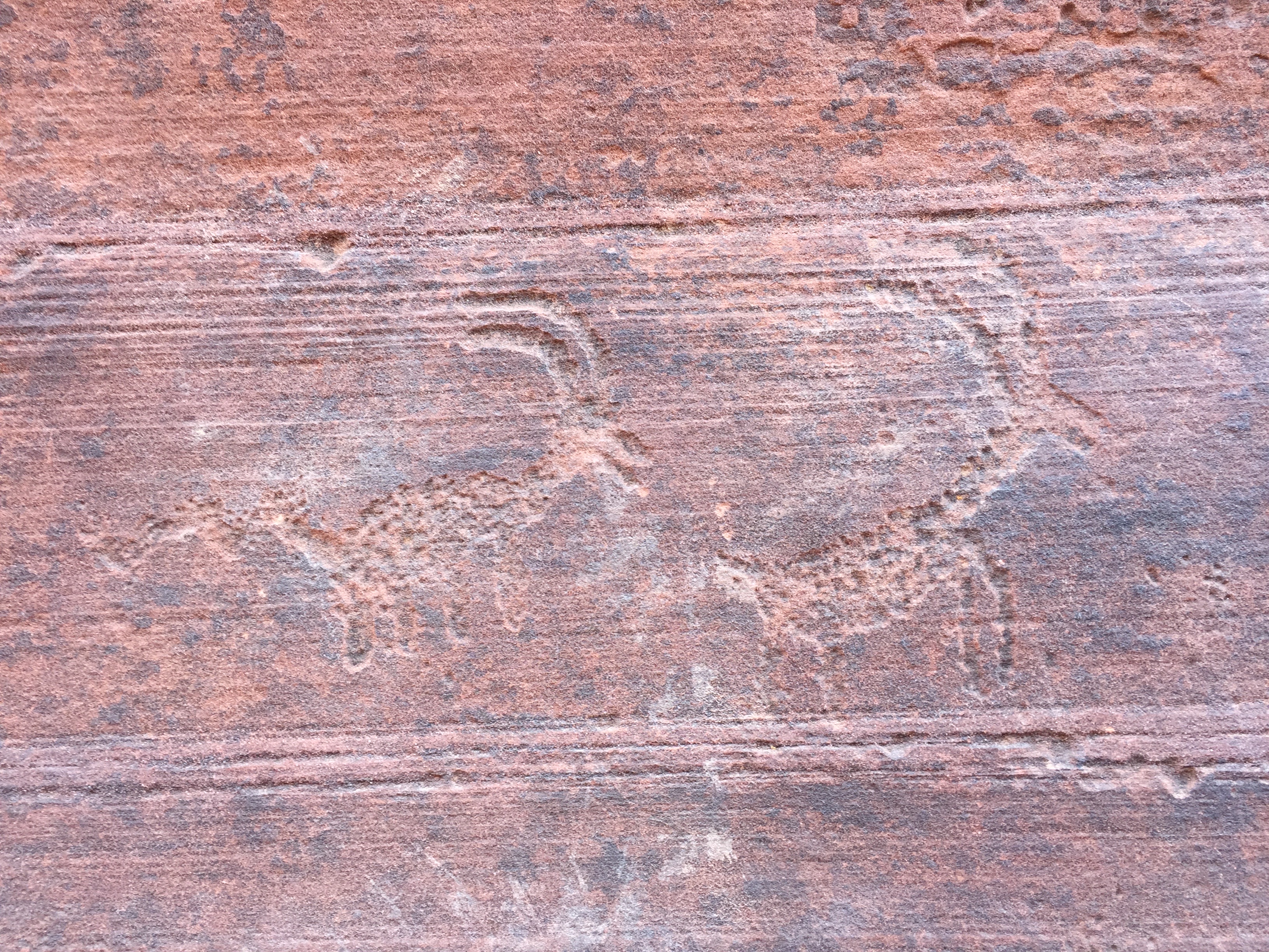
It was at the junction that we saw a few other hikers, some coming from Wire Pass, and a few exiting the main canyon heading westward from the middle trail toward Wire Pass. Chatting for a few moments to talk about what we saw, the trails, and the petroglyphs.
But soon enough, it was time to press on – it was nearly 5 miles back to the car, and we still had a bit of driving to do before arriving at Page, AZ for the evening.
From a hiking perspective, the hike was easy – total elevation change not much more than 250 feet over 5 miles, and the footing was good, though sometimes sandy. The big concern would be flash floods, though we didn’t have to worry about that – there hadn’t been rain in many days, and none was predicted.