GR10 – Gabas to Gourette
Posted by pdittman on September 24th, 2018 in '18 - Pyrenees-GR10

The Gabas to Gourette section of the GR10 probably falls into the category of “what were we thinking!”.

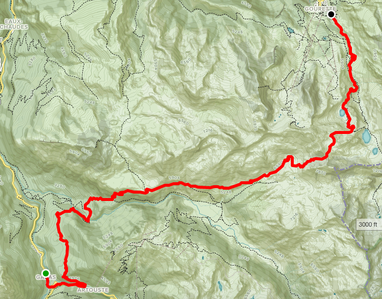
On paper, it was big, over 13 miles, with an elevation gain of 5300 feet, and an elevation loss of 4600 feet. A mile up, a mile down! 

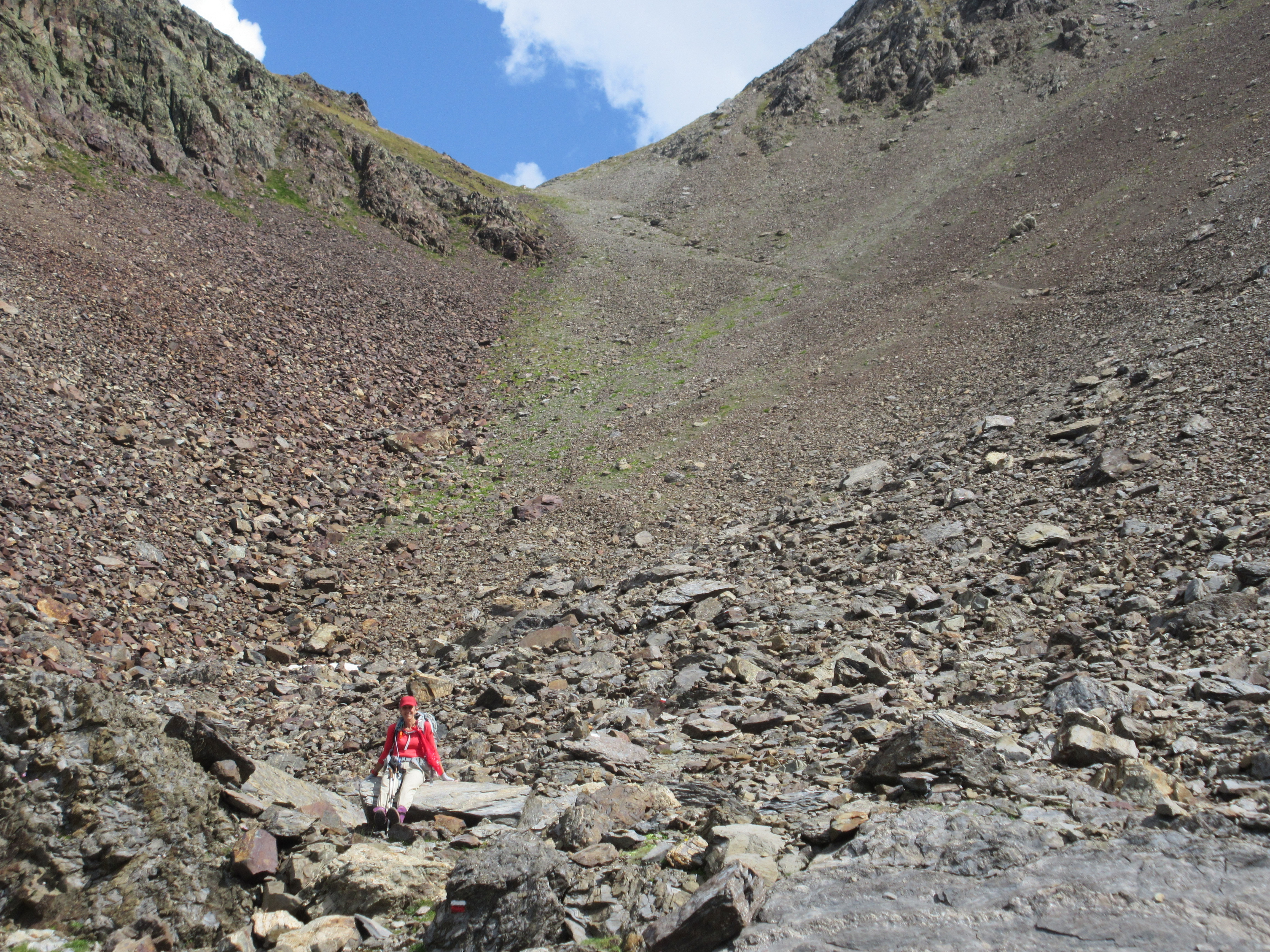
Book time was 8-9 hours, but the GR10 signs were saying nearly 10 hours. We’d already learned to respect the signs. Reflecting back, this hike was epic all around.  Besides the numbers, it had some radically different terrains.  Wooded and rocky leaving Gabas, alpine with vistas through the Gave de Soussoueou, elevation and scree field scrambles to the Hourquette d’Arre, and alpine trekking into Gourette.   Epic!

Route from Gabas to Gourette
Our route from Gabas to Gourette. see it on alltrails.com
GR10 signpost - to Gourette
GR10 signpost – to Gourette

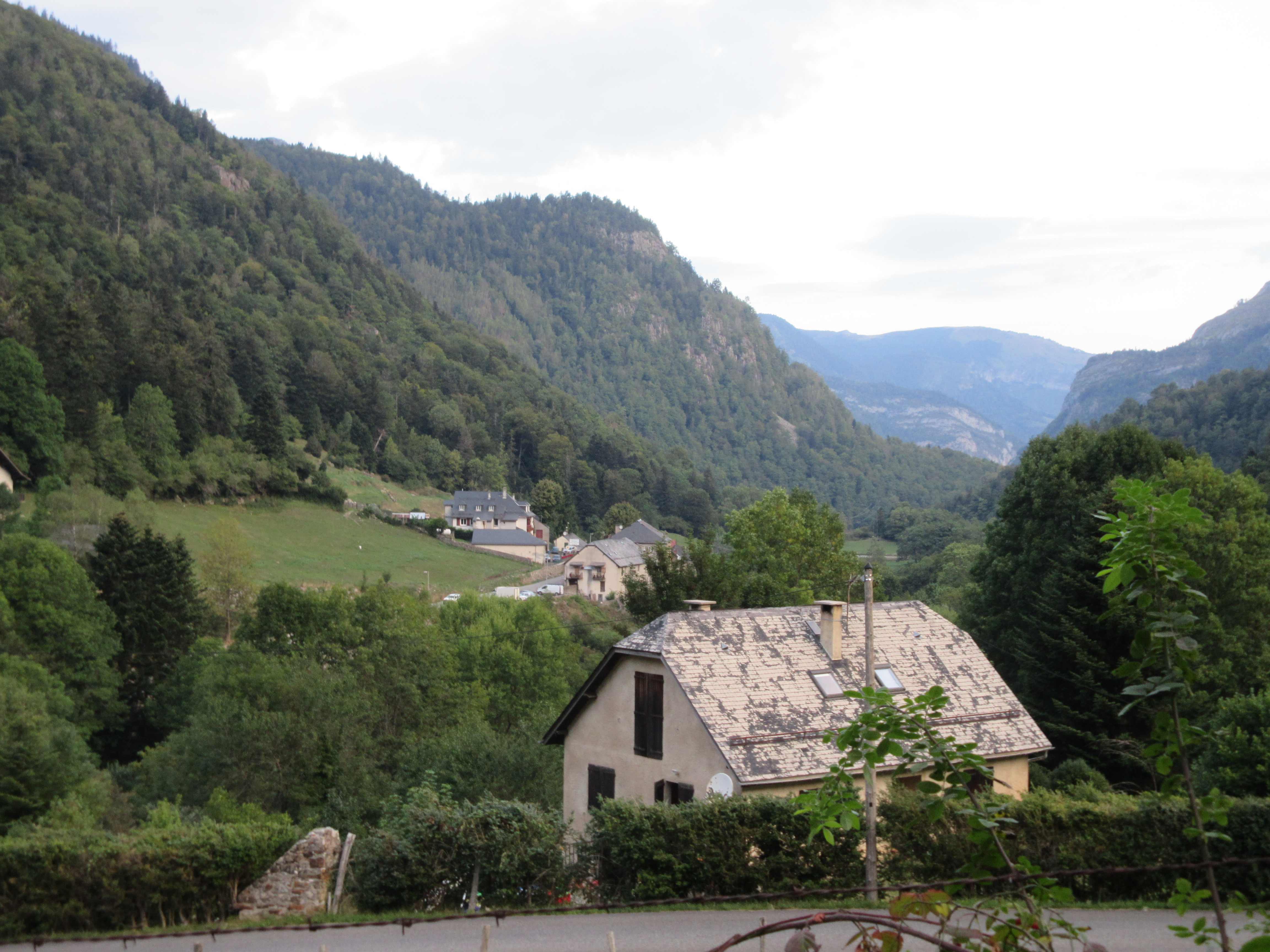
We were up and out relatively early, or at least certainly early judging by the darkened dining area at Hotel Le Biscau. 

After a quick petit dejuener and collecting our brick of brebis cheese we’d purchased the day before, we were back on the trail by 8am, exiting the village and following the roadway a short distance before turning into the woods and gaining elevation.

Gabas - looking northward through the Vallee D'Ossau
Gabas – looking northward through the Vallee D’Ossau

The initial few miles seemed very familiar – wooded and dotted with a few rocks here and there – not unlike the terrain we often see in the White Mountains of New Hampshire.  The woods walk was relatively short-lived though, because the elevation continued to get steeper and the rocks became more frequent.

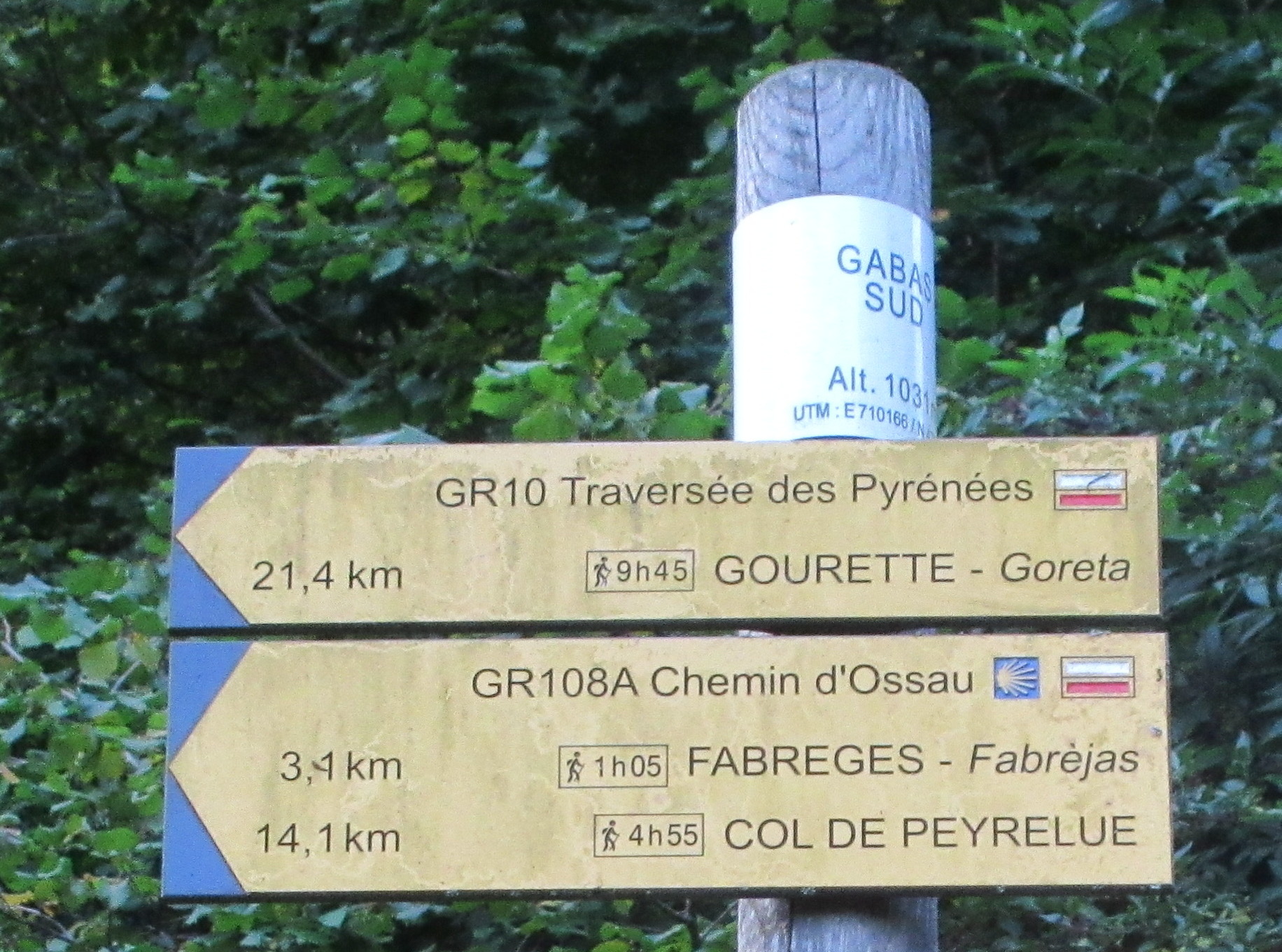
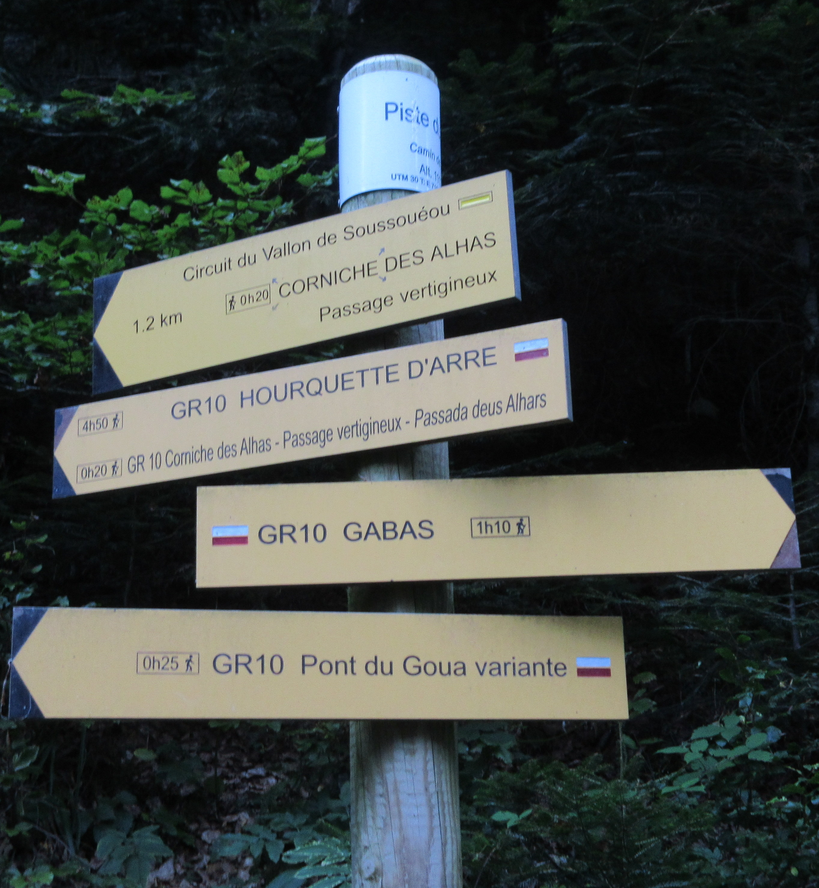
First, passing a hydro power station in a gorge, buried deep in the woods (how’d they do that?), and shortly afterward coming to a junction giving us a choice – a “short-cut” or a longer section – both meeting back up about 30 minutes beyond.

Passage Vertigineux - trail junction
Warnings of a vertiginous passage at a trail junction

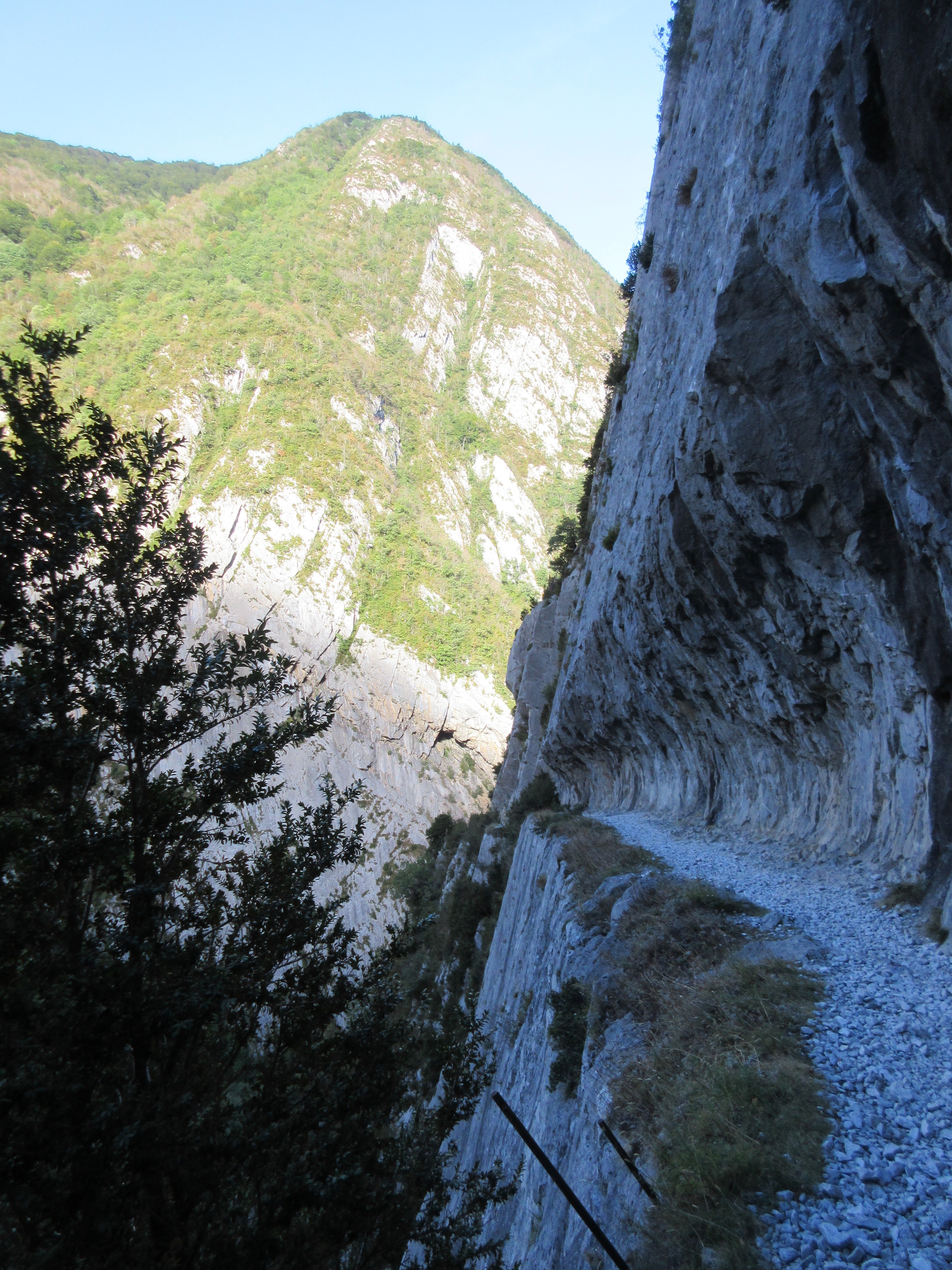
We chose the “short-cut”, though maybe we should study french a bit more. The short-cut came with a ‘warning’ passage vertigineux – the vertiginous passage was indeed that – a trail section skirting a rock wall carved by an old avalanche – the path not quite as wide as what we had on Chemin de la Mature, but equipped with a cable through it’s length.

Cable-assisted "passage vertigineux"
Cable-assisted “passage vertigineux”

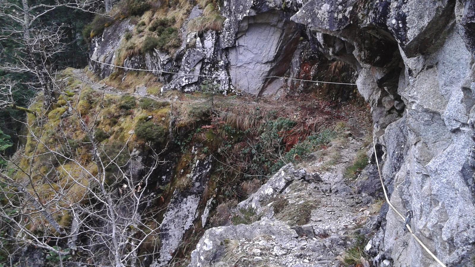
Fortunately, my vertigo didn’t kick in (too much!) – maybe because of the trees on the lower slope.  It was still slow going through the section, regardless, but soon enough we left the cable behind and continued on the rocky and wooded ascent, gradually emerging into the alpine zone again.

Emerging into the Alpine zone

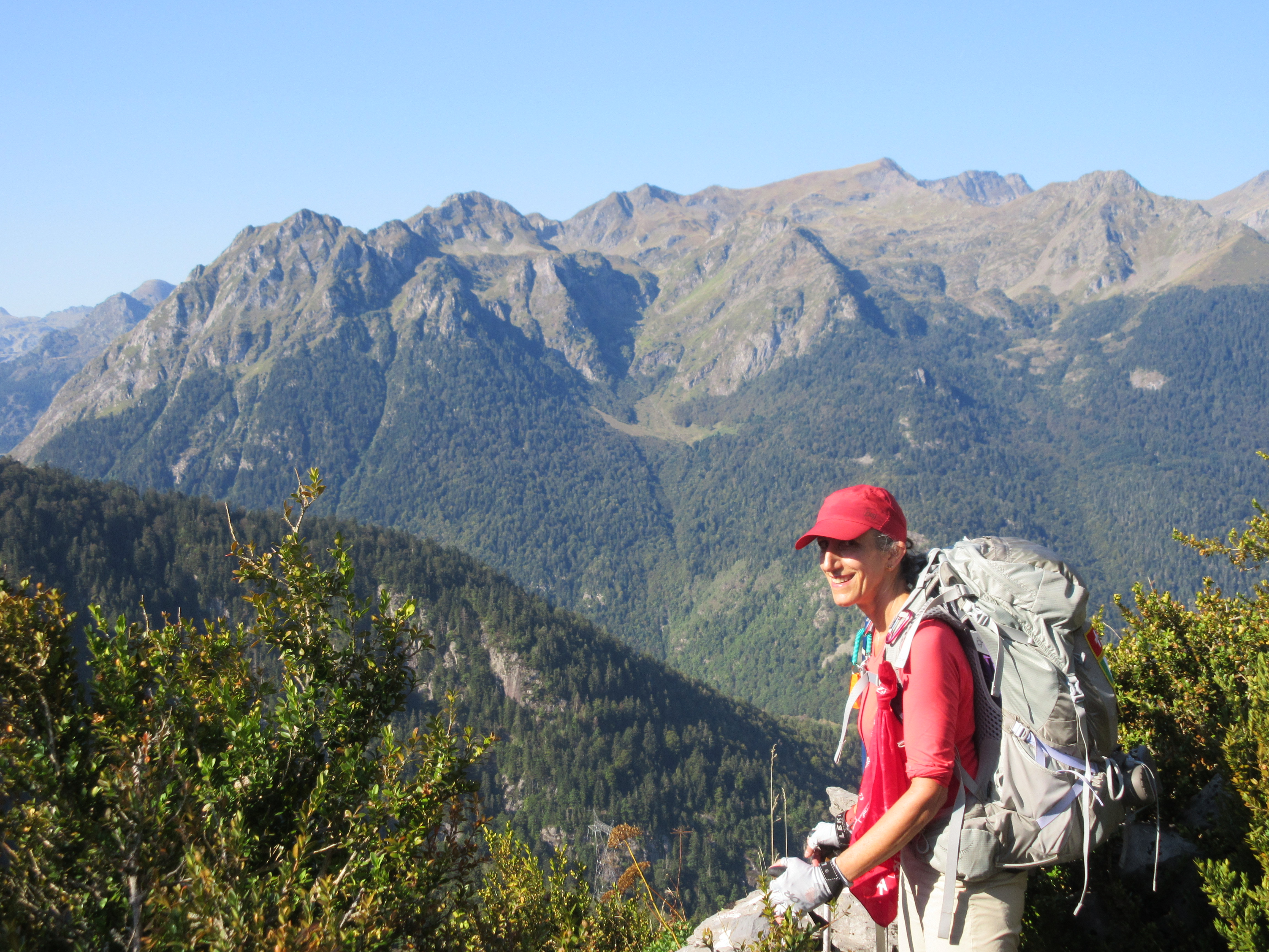
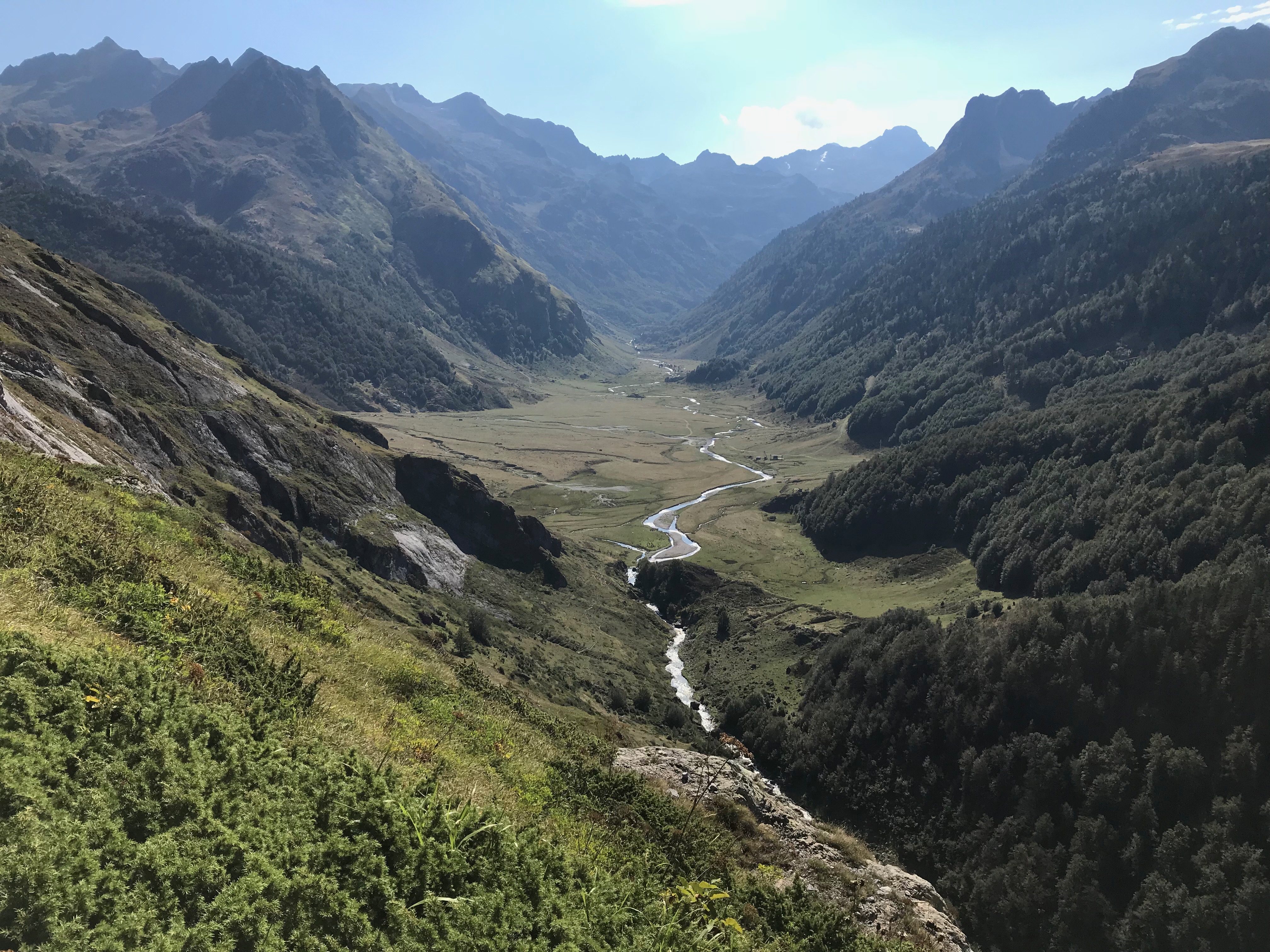
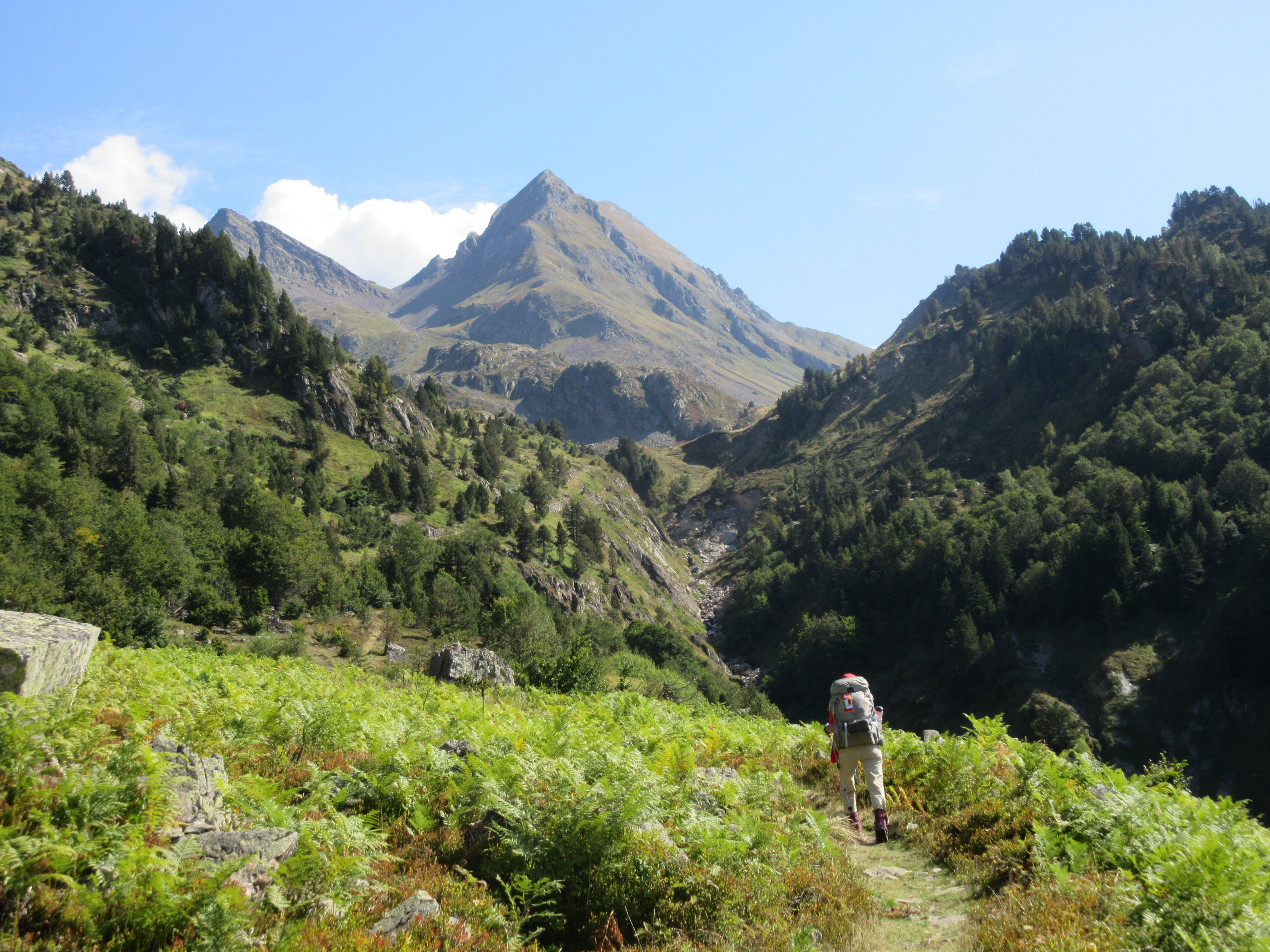
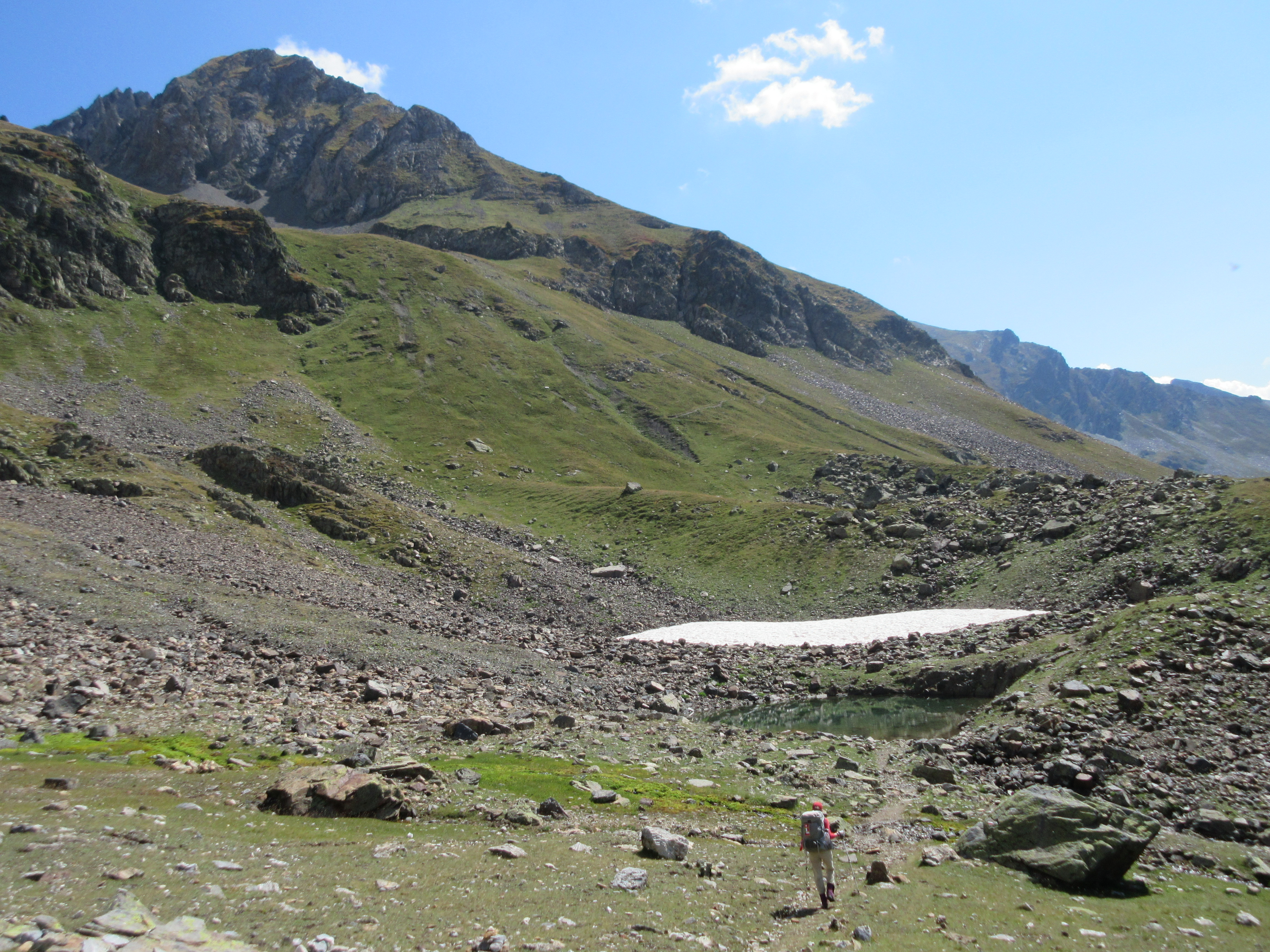
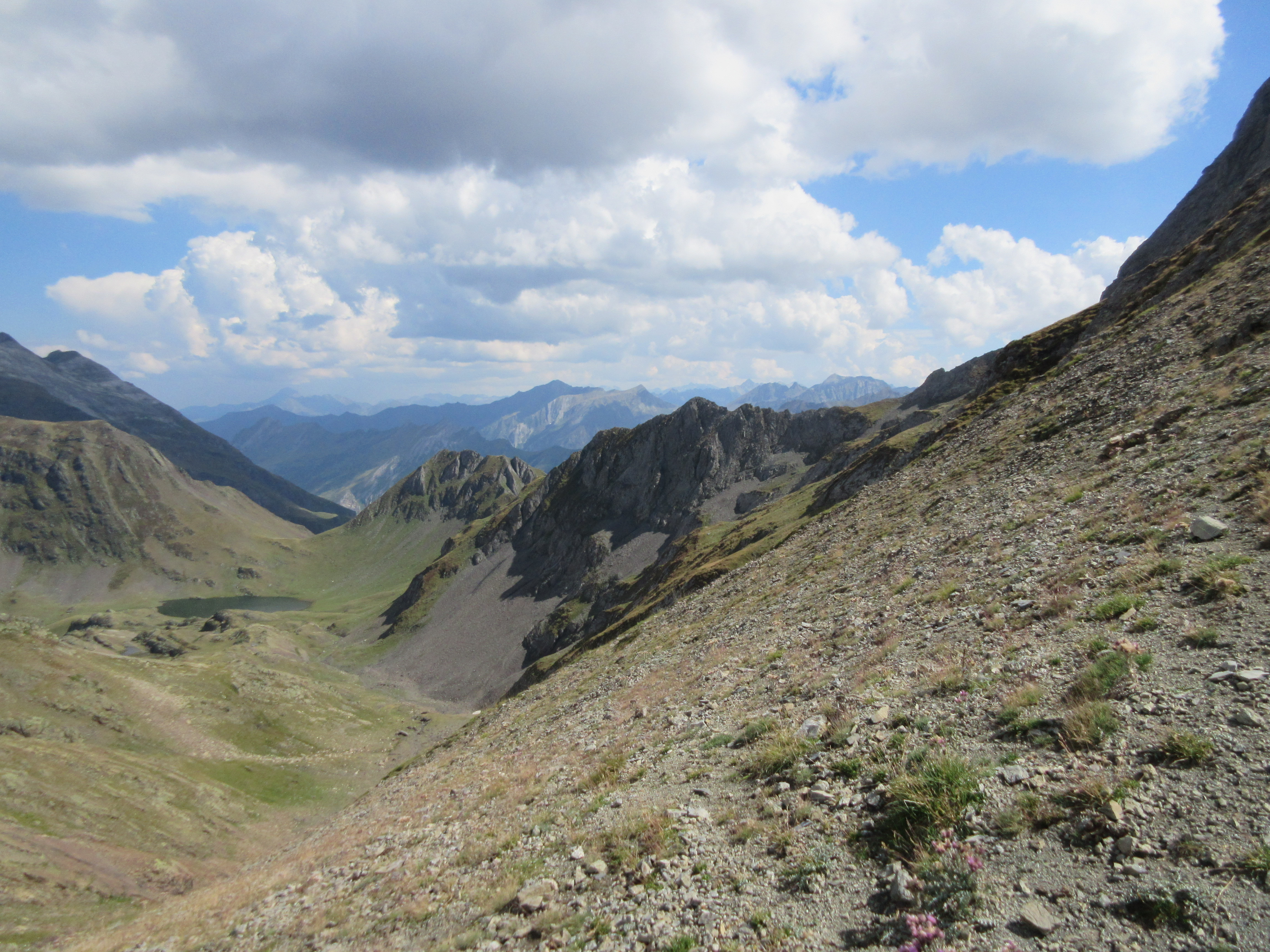
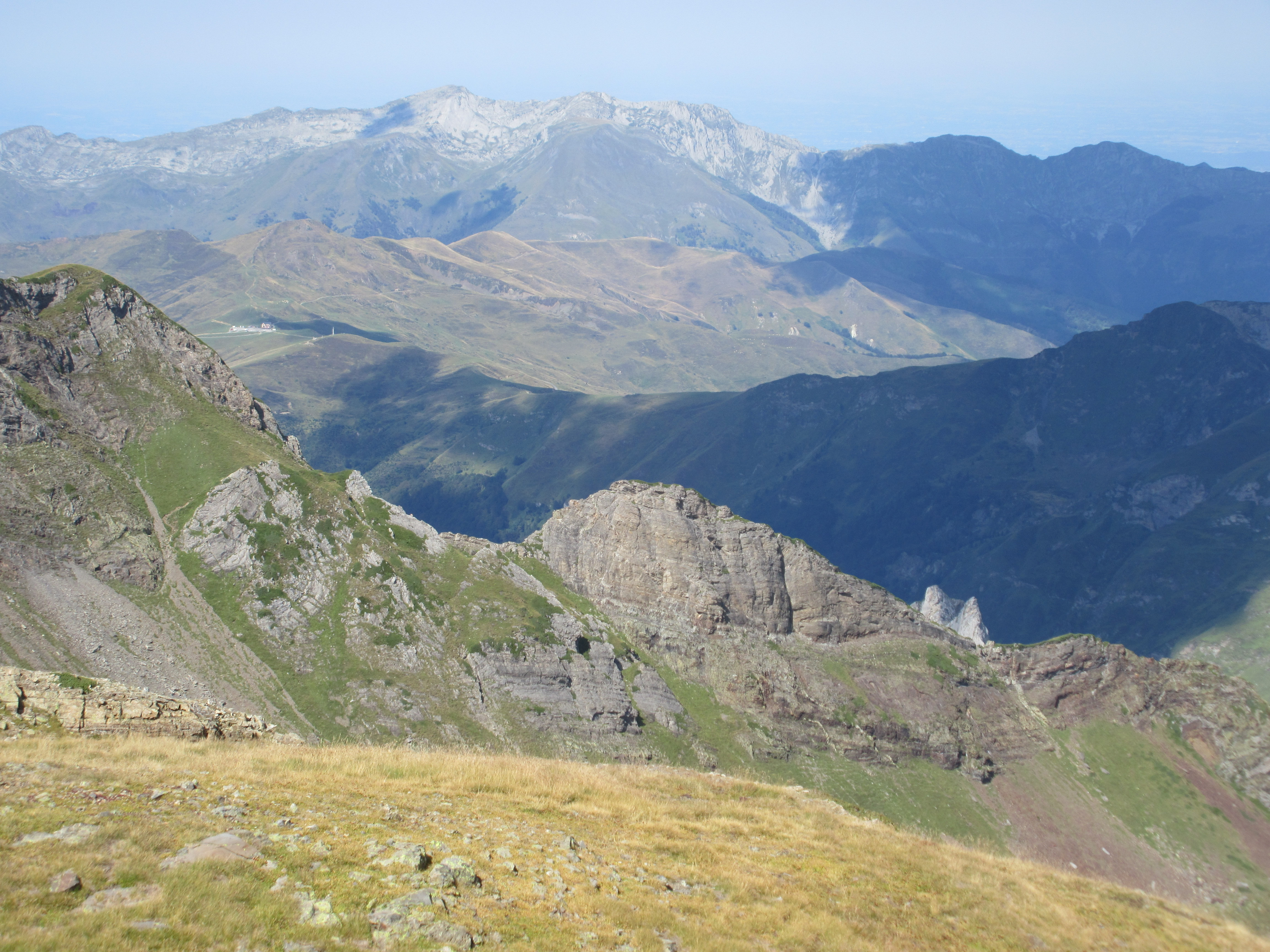
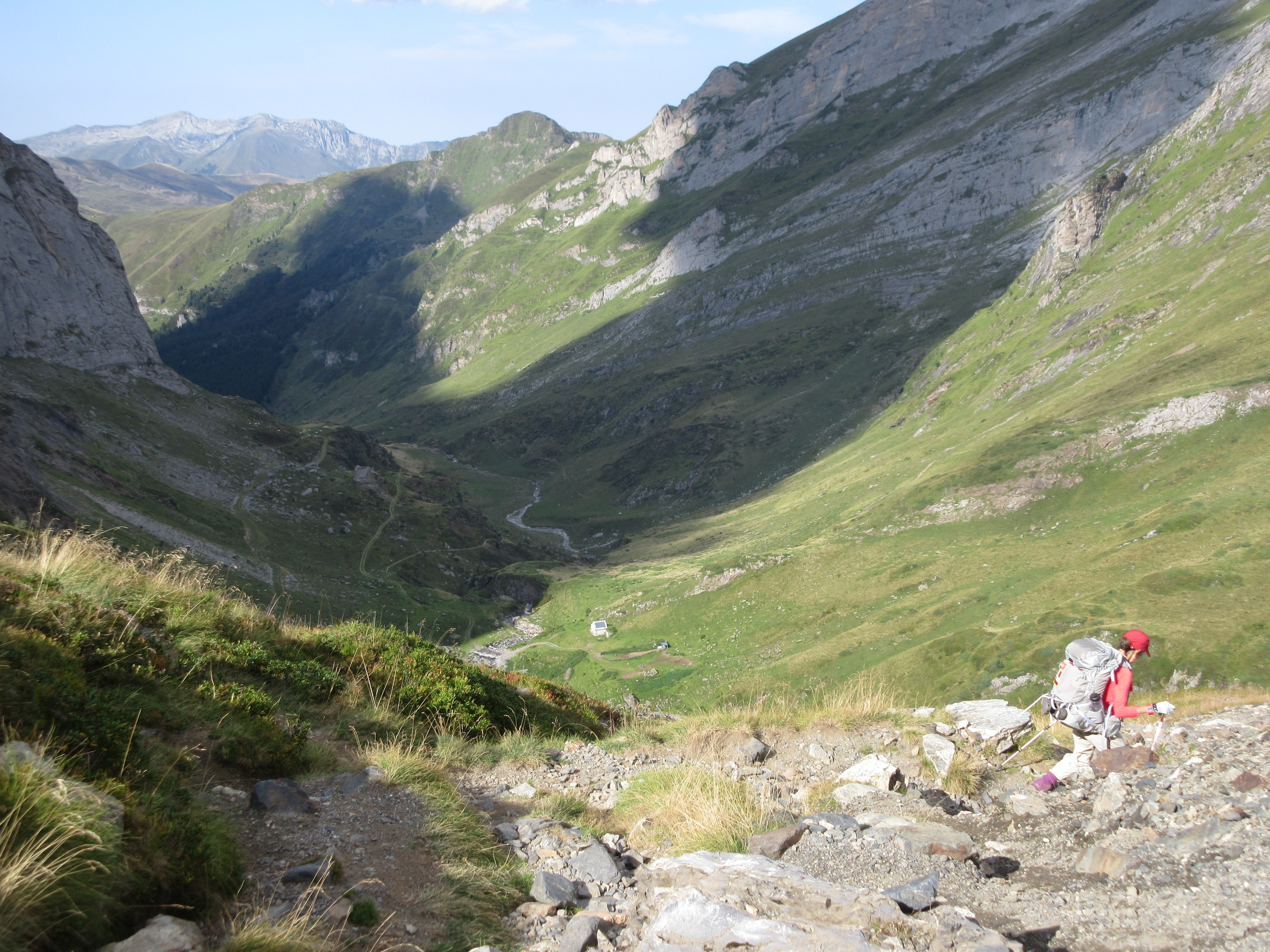
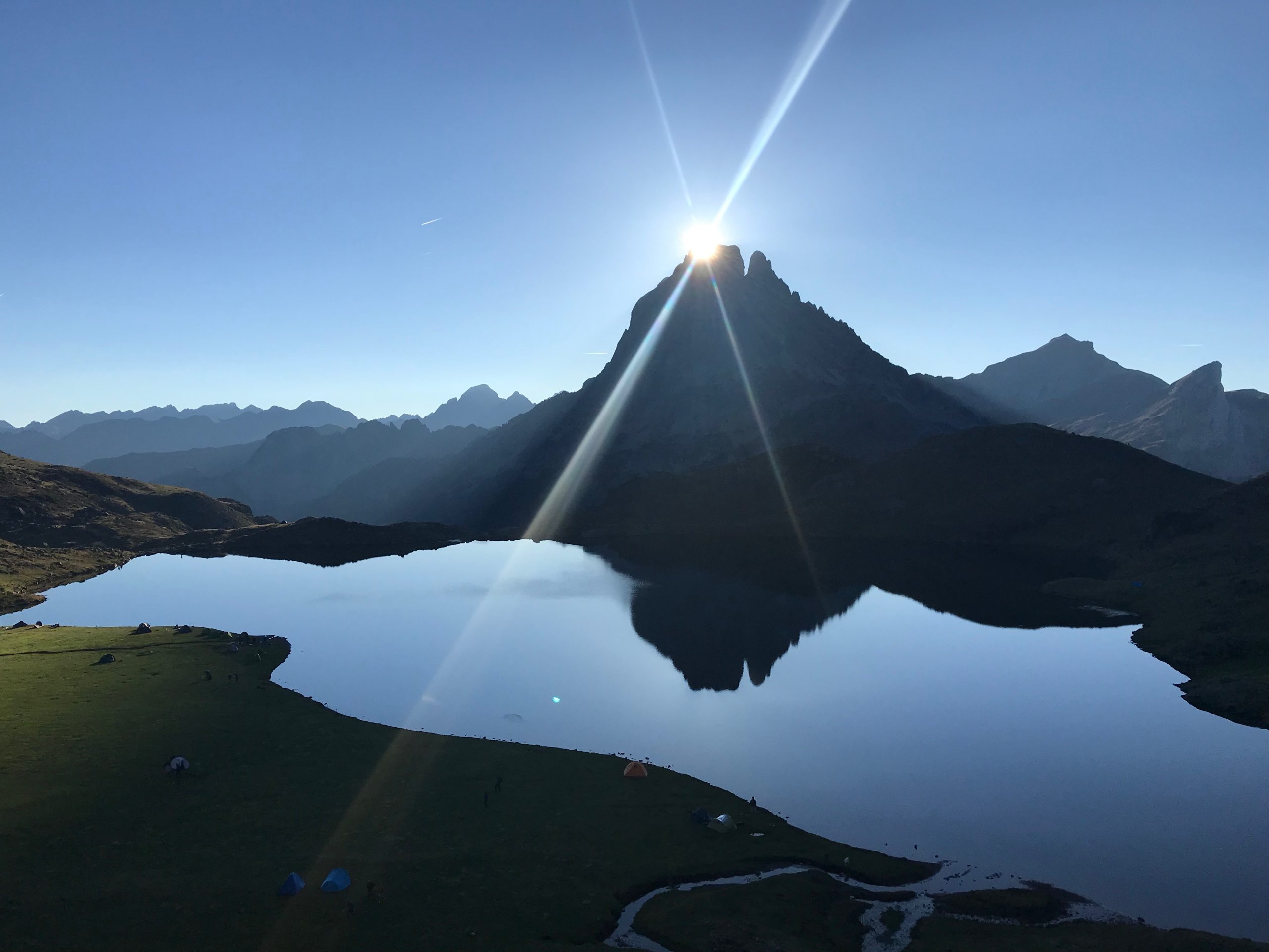
Beautiful and challenging as the wooded section had been, time-wise we’d only covered a bit over 3 hours, and still had 6 hours to go (remember, in the Pyrenees, hiking distance is measured by time, not by actual distance).    This was where the real hiking started!   The trail opened up, following along a slope headed in an easterly direction toward Hourquette d’Arre (the highest point of this GR10 section) and Gourette beyond, and which looked out into the Plain de Soussoueou carved out by the Gave de Soussoueou (see the pictures below).

plateau de cezy
Plateau de Cezy – 6 hours to Gourette!

Rather than blather on about the hike, the elevation gain, the views, the snow (!), let’s just let the pictures do the talking…

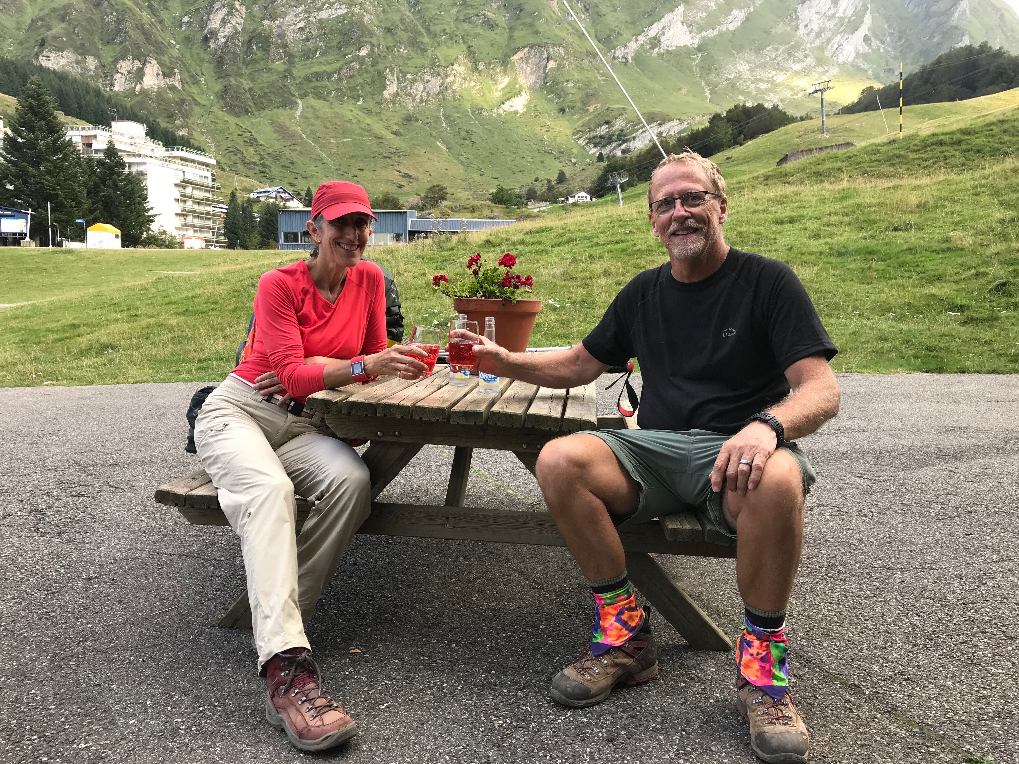
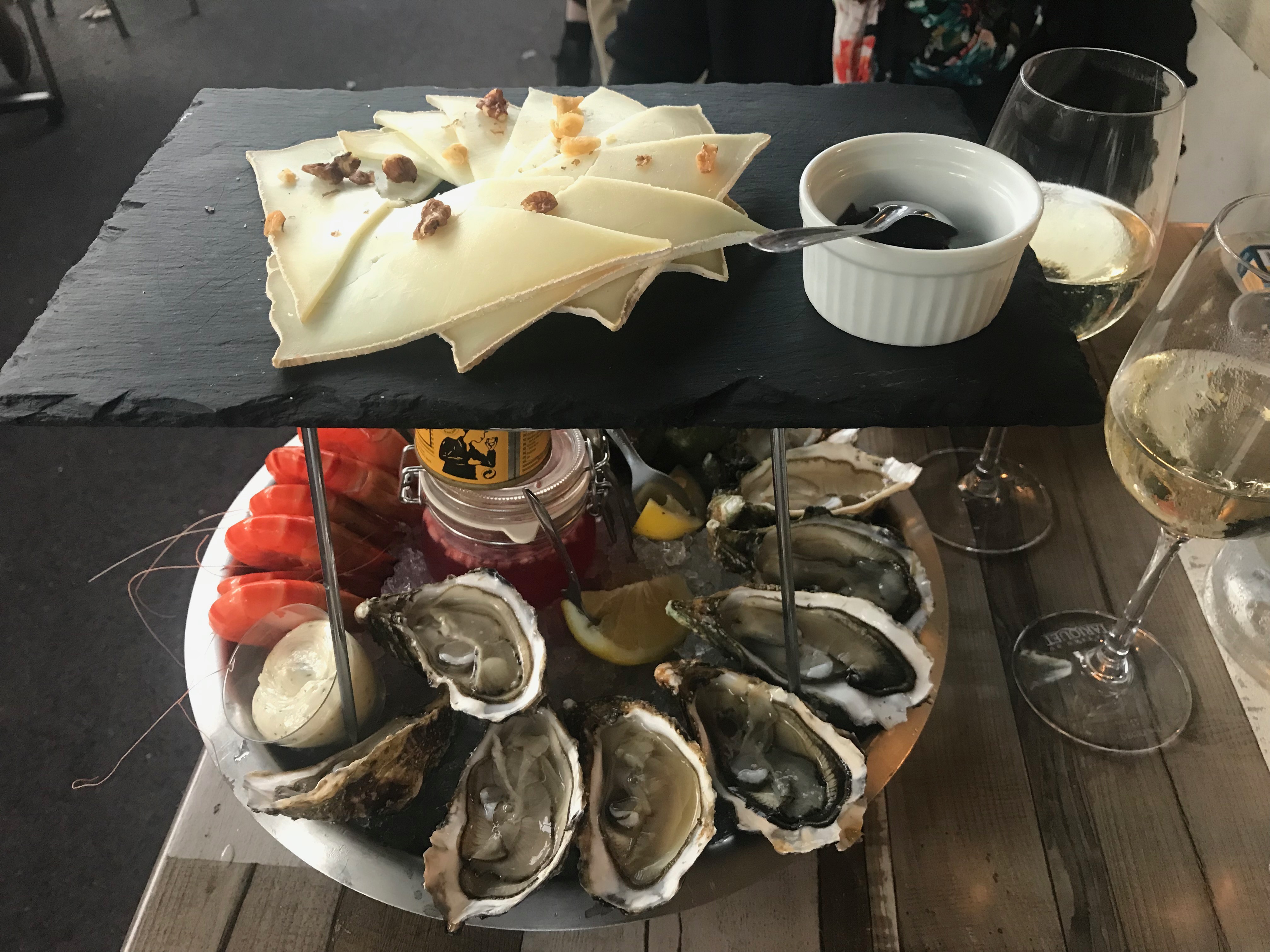
But before departing, a few words about Gourette.   It is a classic European ski resort area – earily quiet in this shoulder period between some summer months and just prior to their high season.  We stayed at a mountain hotel – La Boule de Neige – hosted by Claude and Isabelle Soule.   We were their last visitors before some well-earned vacation for them prior to what is undoubtedly a very busy winter season.    For us, it was perfect, very quiet, very welcoming, almost as if we were visiting friends.  It was just the right way to end some Epic hiking in the Pyrenees.

Below are some pix, beginning from our emergence into the lower alpine zone, headed toward Hourquette d’Arre with a beautiful view of the Plain de Soussoueou.

gave de soussoueou
View southward at the Gave de Soussoueou, with Station d’Artouste on the ridge to the right.


The Hourquette d'Arre saddle in the distance
With the Gave de Soussoeou off to our right, the Hourquette d’Arre saddle was visible in the distance
Approaching hourquette d'arre
Approaching the Hourquette d’Arre with a patch of snow up ahead.
hourquette d'arre
On the scree field leading to Hourquette d’Arre
hourquette d'arre
a Looking back from whence we came – toward Gave de Soussoueou
col d'aubisque
View from the Hourquette d’Arre toward Col d’Aubisque – Gourette is in the valley beyond the ridge line to the left
gourette - valley
Descending from Hourquette d’Arre into the valley leading to Gourette
gourette
Celebratory Campari and soda at Le Boule de Neige!

2 Comments

  1. Pingback: Hiking/Trekking
  2. Pingback: Hiking/Trekking

Leave a Reply

Your email address will not be published. Required fields are marked *

**Please add a comment

**Username is missing

The GR10 and Nouvelle-Aquitaine Region
It all started with a conversation with some Brits while we were on our first multi-day trek in Alpiglen, Switzerland in 2012.  They talked about the GR10 as a long distance hiking trail between the Mediterranean and the Atlantic coast paralleling the Pyrenean/Spanish border in France. What’s a GR?   France is virtually blanketed with long distance hiking trails – Grande Randonnée – with the GR10 stretching from the Atlantic to the Mediterranean, covering a distance of roughly 540 miles and typically taking 50+days to traverse. Fast forward six years…
Read More →
Lescun to Etsaut – oops!
We’d planned to be on the trail on the day after arriving in France. Always a bit risky in the event our backpacks got lost in transit – but we arrived in Paris as did our backpacks, and transferred to our Paris-Pau flight without incident. Arriving in Pau, we were easily able to get on the P20 bus to take us into downtown Pau – location of Hotel D’Adour, the hotel we were using to bookend our hiking. Only a few days
Read More →
GR10 – Etsaut to Refuge D’Ayous
Our first real day of section hiking the GR10,  was a fairly big day.  The cicerone guide we’d been using as the basis for the trip had listed the section as Etsaut to Gabas – a 14-15 mile, 5,000 feet of elevation gain, monster of a hike.  Daunting on any day, more so because we’d be with full packs. Fortunately, we discovered and were able to secure beds at the Refuge D’Ayous – a mountain hut staffed by (what seemed
Read More →
GR10 – Refuge D’Ayous to Gabas
We’ve stayed at Refuges on some of our other trekking experiences – we’re really not backpackers/campers – most often, you can find us at one of the Appalachian Mountain Club huts in the white mountains of New Hampshire, and we’ve also stayed at Refugios in Torres del Paine in Chilean Patagonia (such as Refugio Grey), and the Berghaus’ which dot the Jungfrau region of the Swiss Alps (see our blog on the Jungfrau).  Staying at the Refuge D’Ayous hut would be yet
Read More →
Goodbye to Pyrenees, hello wine and oysters!
We’d finished up our GR10 section hiking in the village of Gourette – a ski resort nestled in the Pyrenees about 30 miles south of Pau – our starting and ending point for our adventure in the Pyrenees. In the high season, one can catch a bus from Gourette to Pau, but in the shoulder season, the Pau bus leave from Laruns – a nearby town.  We’d planned to walk from Gourette to Laruns for the bus, but arriving in
Read More →