It was still the era of COVID and we’d cancelled our Canadian Rockies trip, so it was somewhat ironic that part of our quest for the New England Highest Hundred would take us into Canada.
Boundary Peak lies about 20′ inside the American border, but the easiest access and the one we chose, had a trailhead within Canada. It was a beautiful day so we set off from our AirBnB in Carrabassett Valley, northward to the border, about 35 miles.
Did I say, it was still COVID? Once we got to the border, we had our passports and all, but what we didn’t have was our COVID vaccination information in the App used by the Canadian border patrol to verify vaccination and and a plan should we test positive.
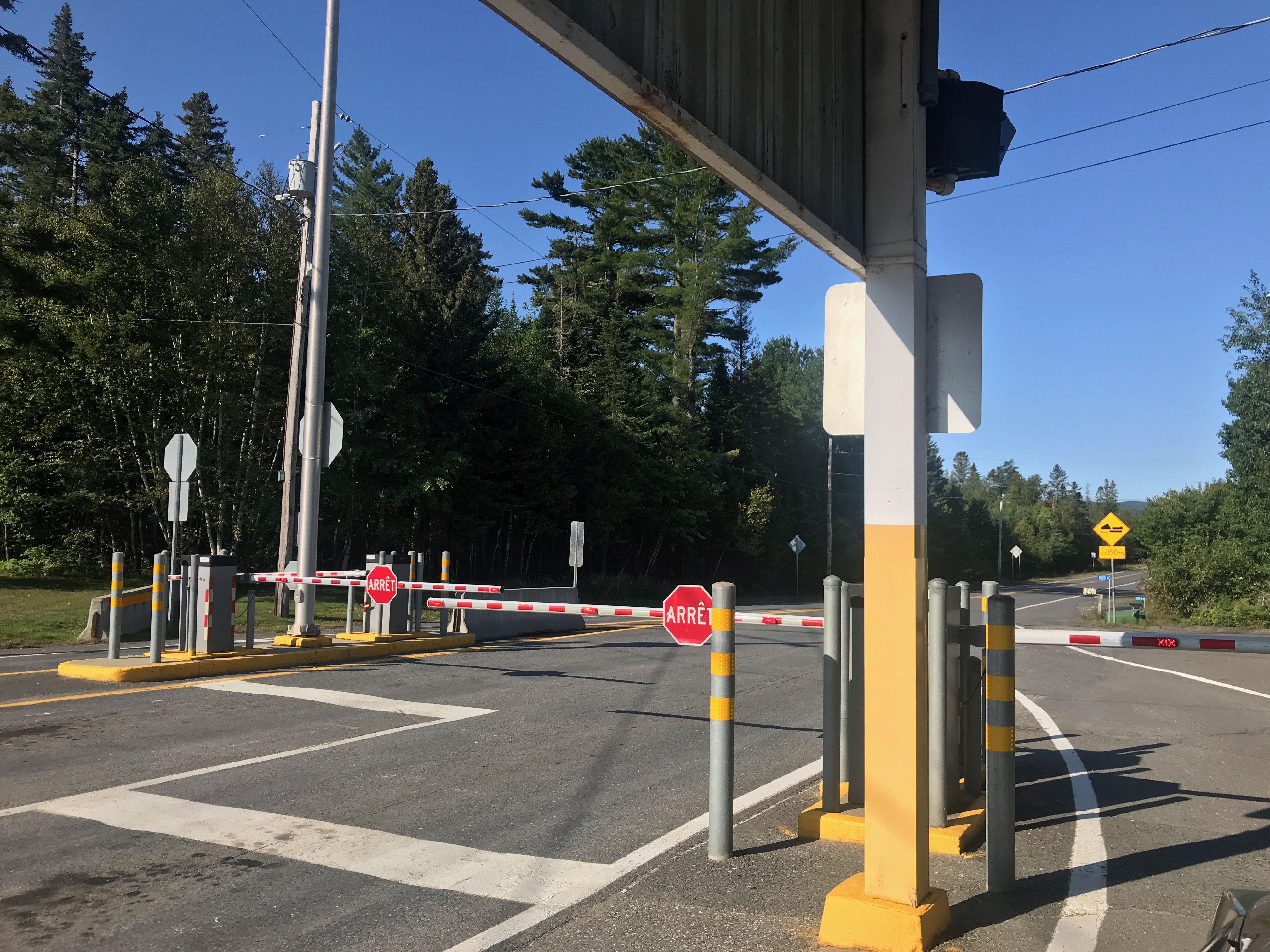
Well, that proved a bit of a challenge. We needed to download the app and enter our information so they could check in their systems.
BUT, This is really out in the middle of nowhere. Like, no wifi, no starbucks, nothing. So we began to drive southward until we regained a cell signal strong enough to download the app. Interestingly, the app only allowed one to enter a Canadian address for the “isolation plan” – the place for isolation in the event of infection. We channeled our Canadian cousin in Toronto – 600 miles away! We didn’t care, it let us “check the box”
An hour later, we were back at the border with our information and were able to proceed to the trailhead – offering us another hurdle – we needed a permit to hike in the provincial park – Réserve Écologique du Mont-Gosford. Fortunately, there was a park station with many people in line, apparently waiting for the same thing.
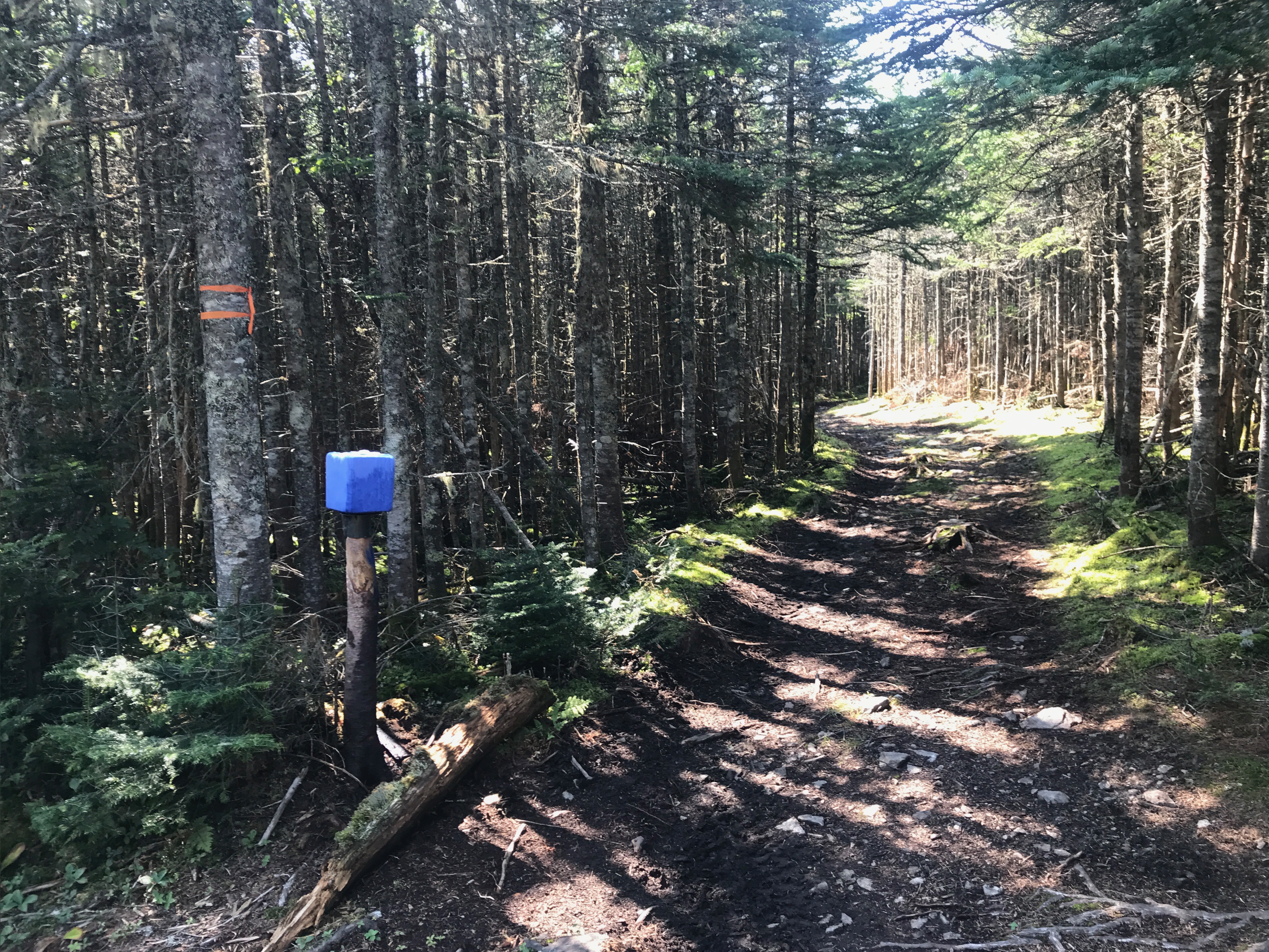
EVENTUALLY, we got to the trailhead – basically the beginnings of an ATV trail providing access to the border itself and the hunting shacks.
Ok, a bit different, but each hike has its own character – this one is no exception.
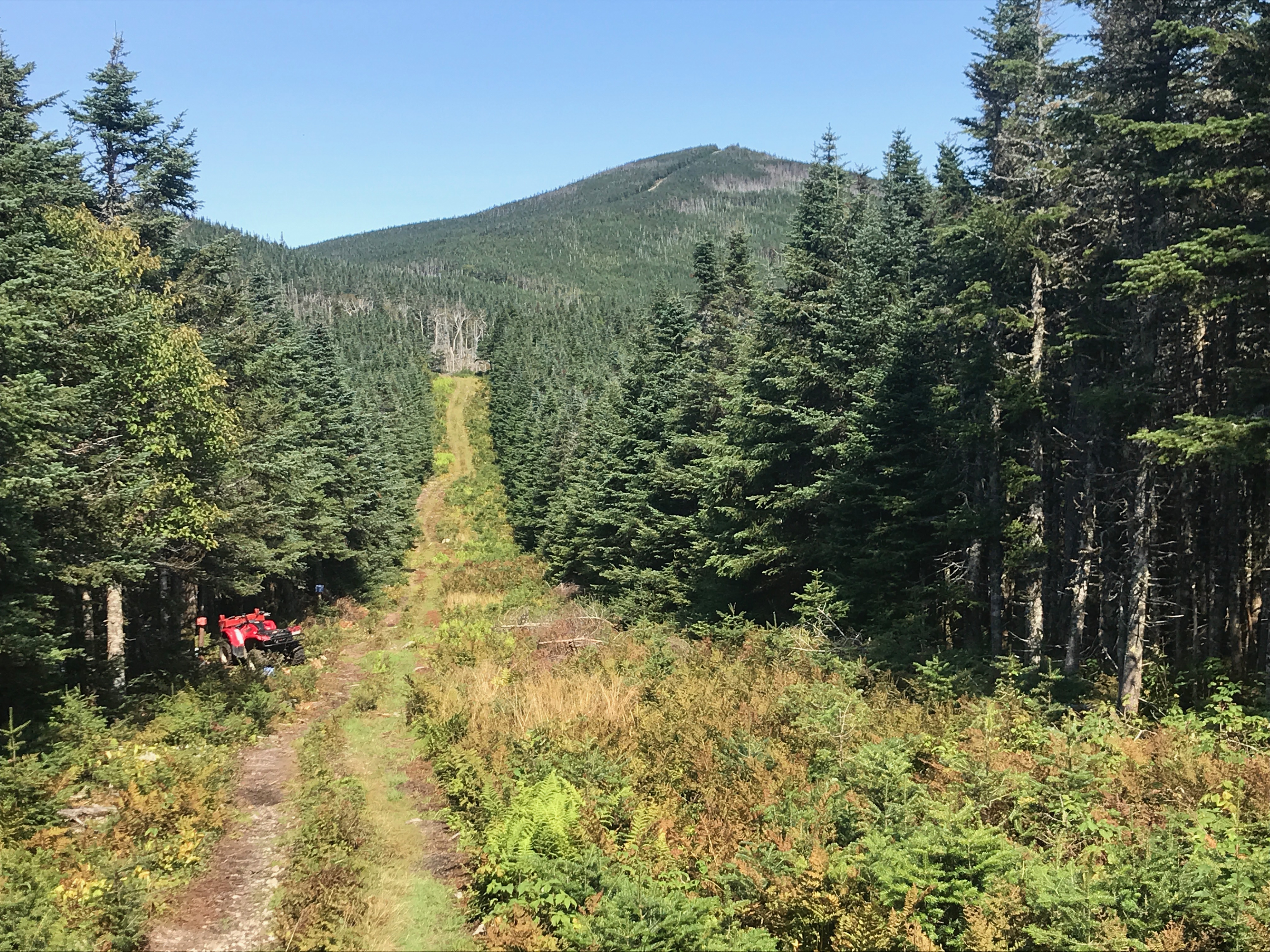
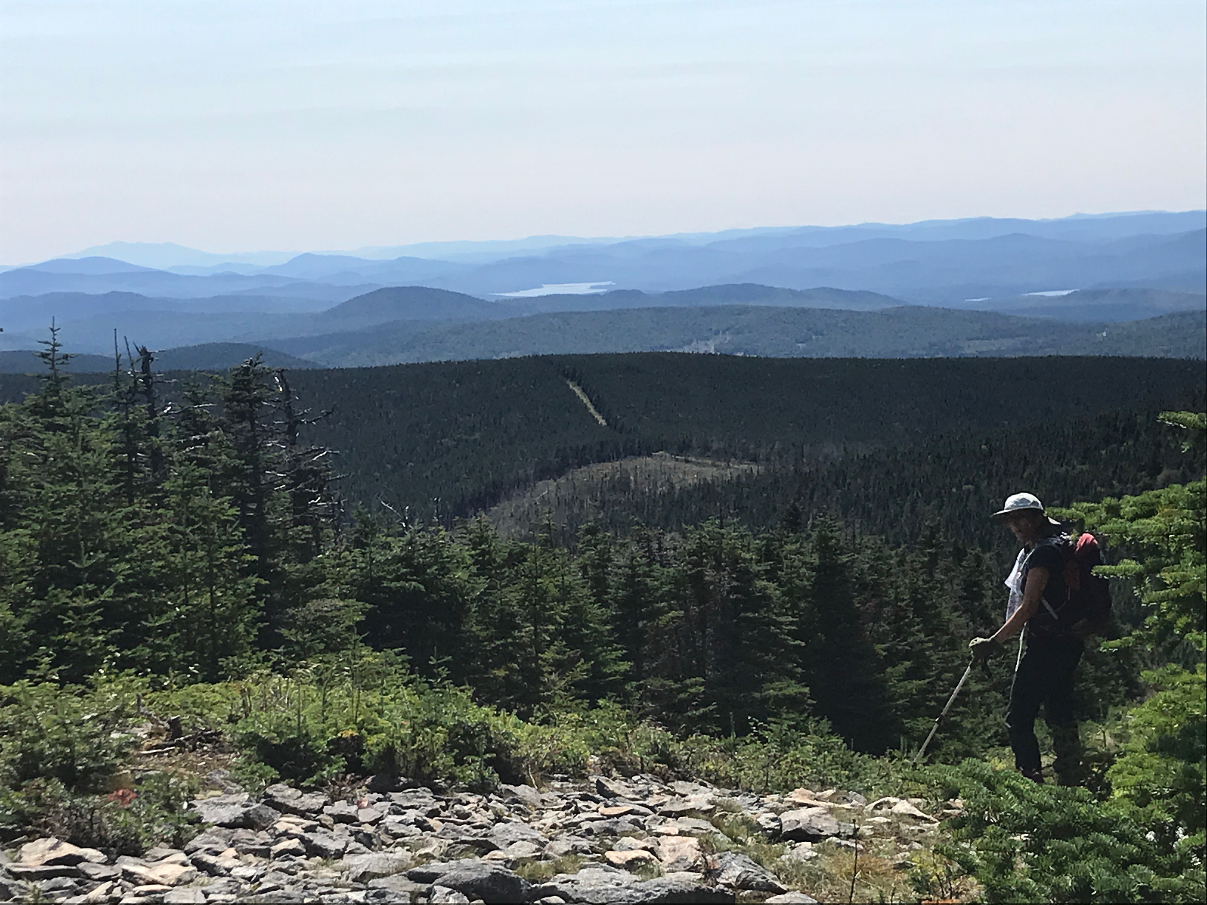
Once we exited the ATV trail and the forest, the remainder of the trail was really a site. Clear-cut through the dense forest was the border – plain as day.
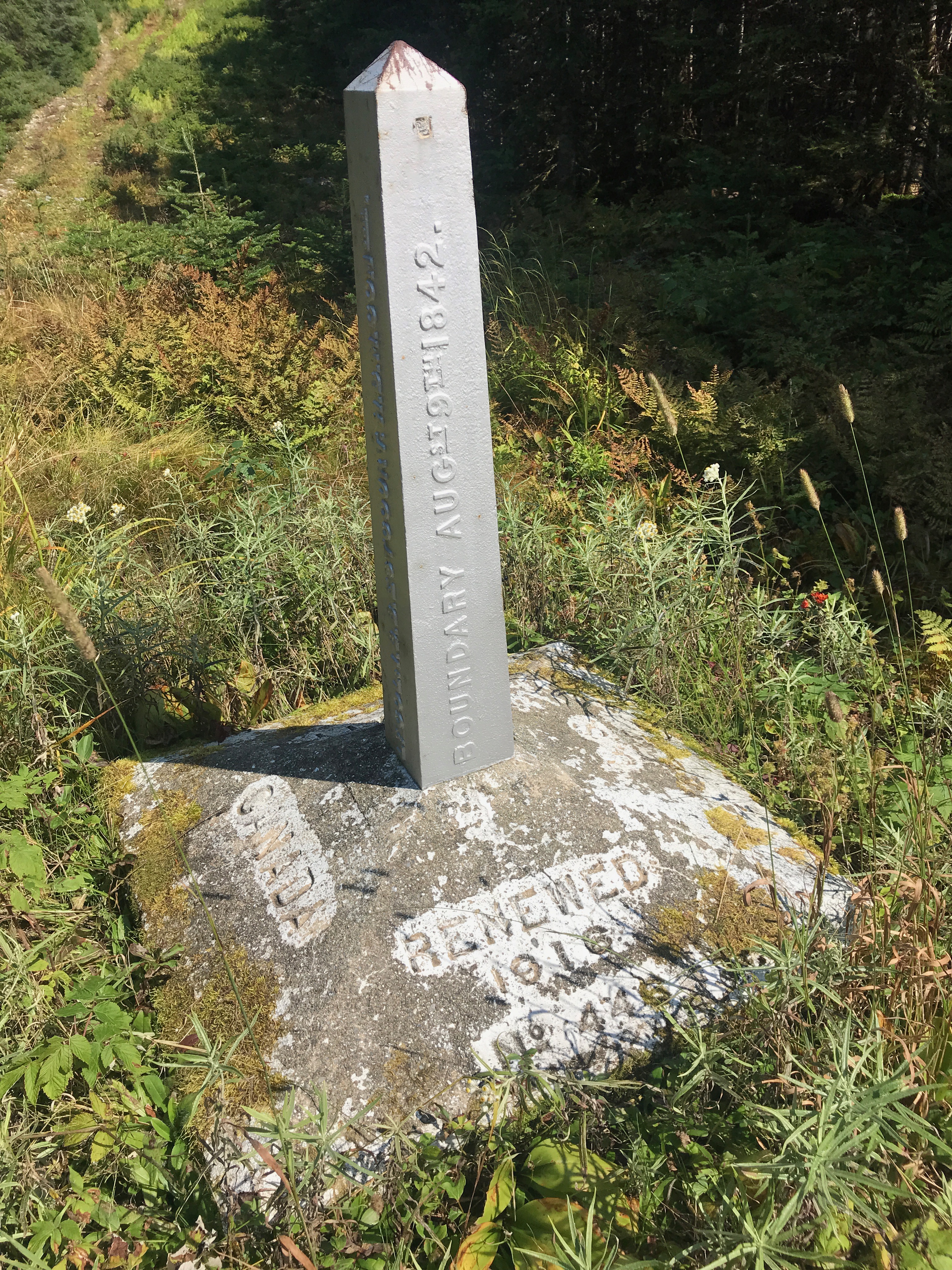
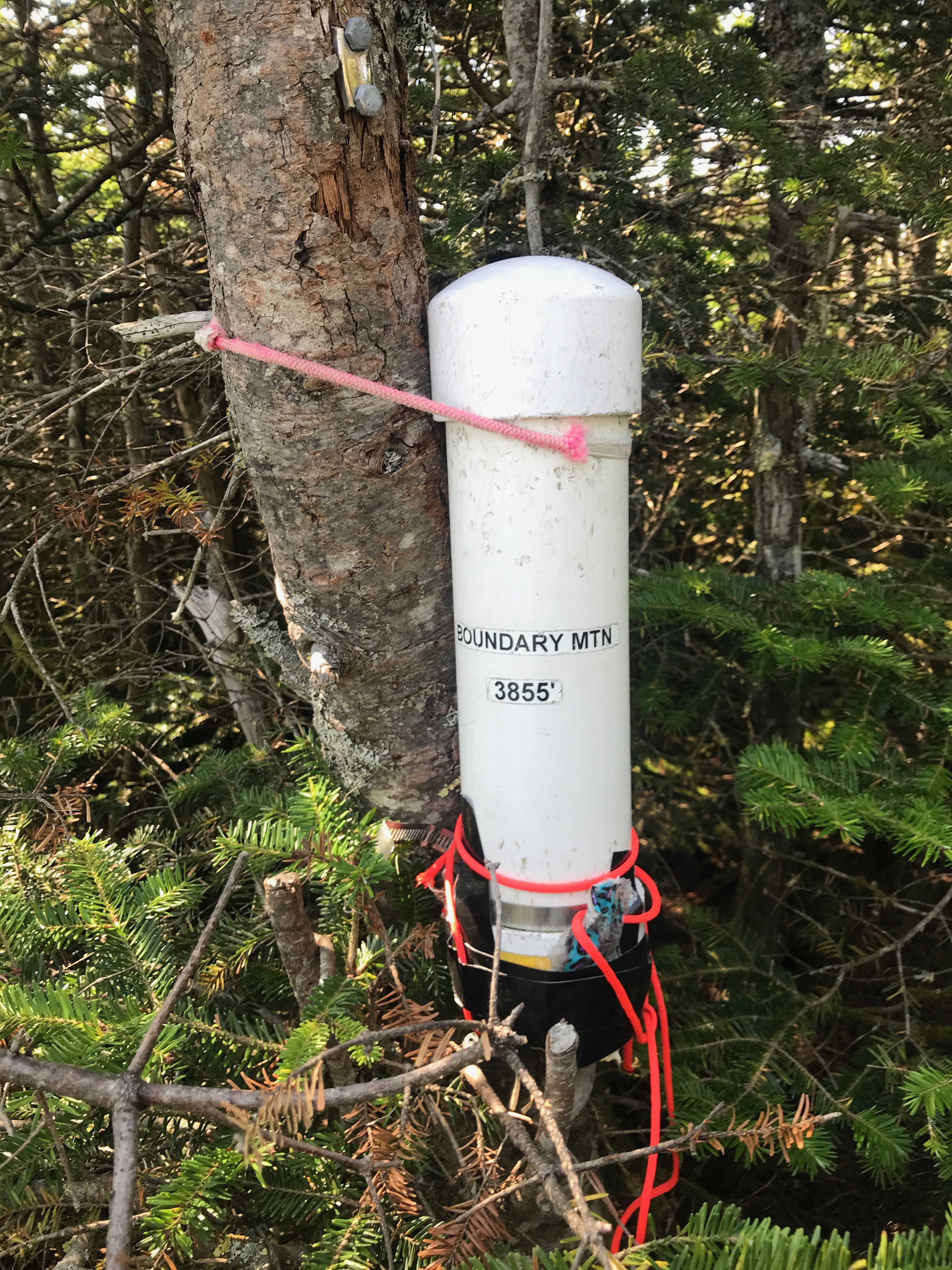
Dotted along the trail were border monuments – clearly an unguarded border!
It really was a beautiful hike, easy trail and all. While the logistics were a bit challenging, it was a beautiful day out with some very rewarding views! According to Garmin, just shy of 4mi and an elevation change of about 1,300 ft. A nice “warmup” for some of our other hikes on the week-long peak-bagging trip.
Comments