The second stop on our west coast adventure was Crater Lake National Park.
As part of our itinerary, we knew the drive times between our stays were all over 200 miles, but it wasn’t until we were making the drive that we began to appreciate the vastness / remoteness of the area.
That 200+ miles drive from Mt. Hood toward our accommodations in Prospect, Oregon didn’t include much “civilization” in between, with only spotty cell service along the way – so things like, planning for gas stops was important.
Merriam Point – Rim Trail
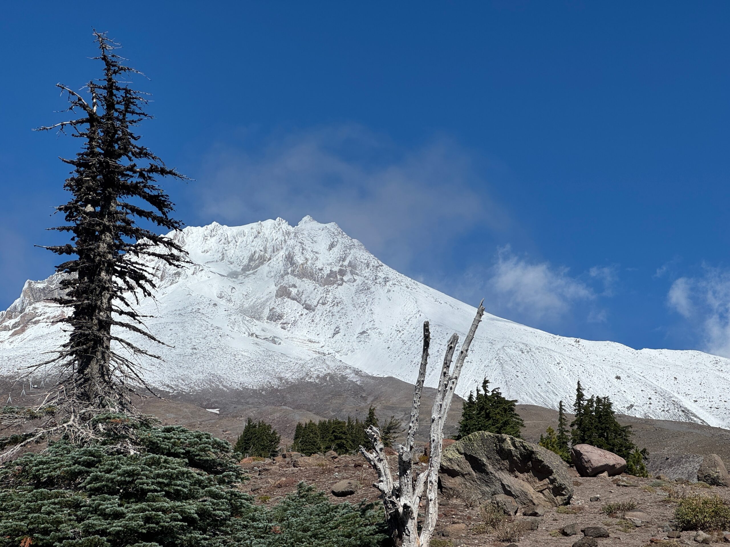
Coming from Mt. Hood, the park’s north entrance provided a great opportunity to stop along the way to stretch our legs. About 8 miles “in” from the main highway (Rt. 138), was a small parking area a few miles from Merriam Point lookout where the Pacific Crest trail (PCT) crossed the park’s north entrance road.
As it happens, our west coast adventure coincided with a “lapse in appropriations” (aka, a government shutdown), which carried the threat of closed National Parks. Fortunately for us, as we were entering the park, the roadway gates into Crater Lake were not closed, though the guard/entry houses, etc. were unstaffed/shuttered.
This being a weekday late in the season, there was hardly any traffic, so we saw only a few cars in the 8 miles from the turn-off into the park.

The trail junction and parking offered access to the Rim trail, which led to Merriam Point, roughly 3.1 miles southward, with about 800ft elevation gain. The walking was easy, with only modest elevation gain. Interestingly, the parking area was at about 6,500ft elevation, seems we’d been gradually gaining elevation over the many miles leading to the park entrance.
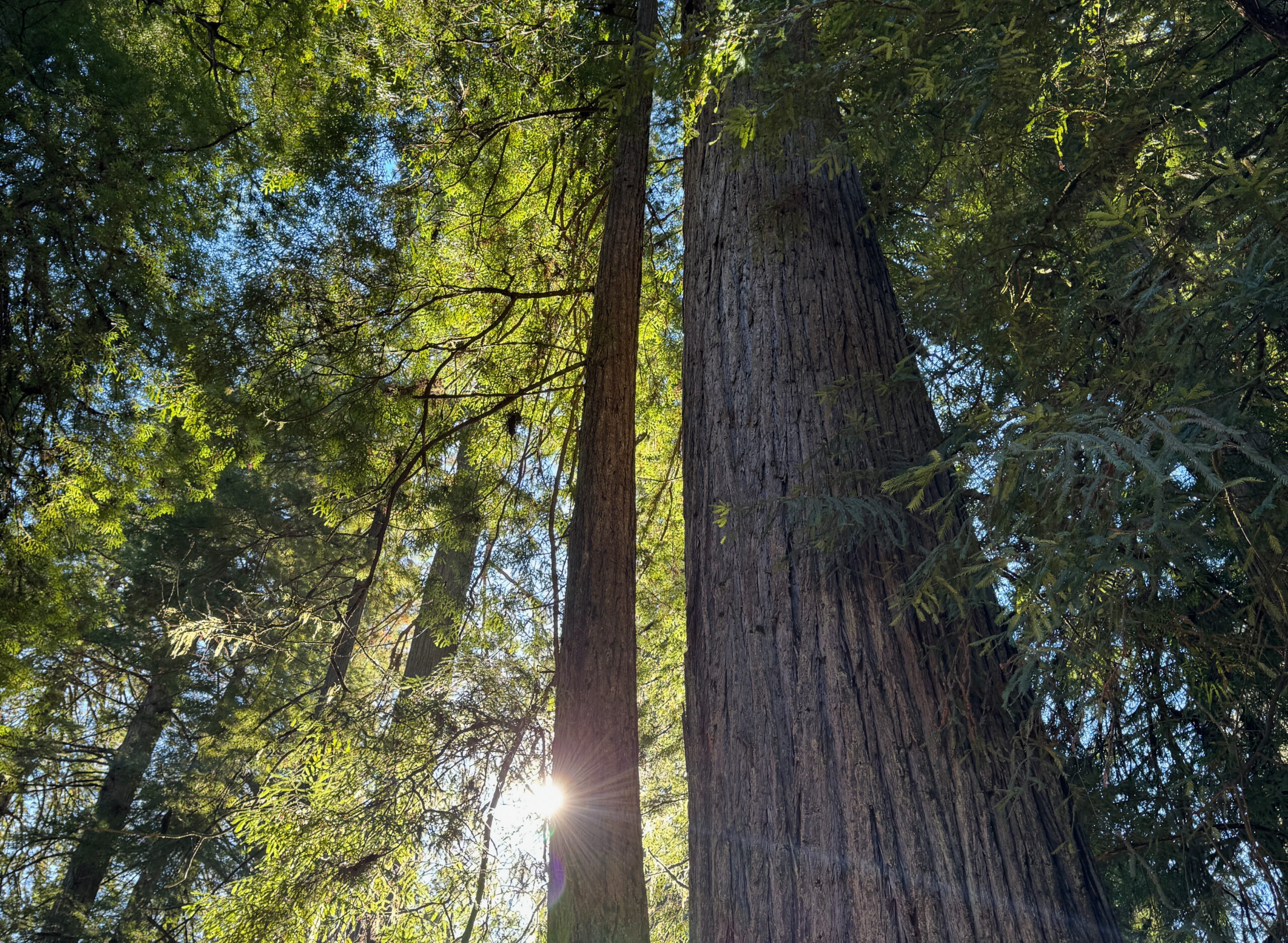
Once on the trail, we started out mainly in the trees, and as we gained additional elevation, the trees began to thin, providing impressive views of the surrounding area.

We steadily gained elevation as we walked southward toward Merriam Point eventually breaking out of the spotty tree covering, essentially above tree line at around 7,000 ft elevation, with the Merriam Point parking area in the far distance.

Soon, we crested the rim at Merriam Point and were treated both to some AMAZING views, and a VERY stiff wind – probably 30mph or better, blowing across the lake!

We didn’t stay long – it was a biting wind, so we quickly turned and retraced our steps back to the car – though not forgetting to “smell the roses” along the way.

And from there, we headed on to our “cabin” in Prospect, Oregon – nearly an hour’s drive from the north entrance trailhead.
It was at this point that we really learned of the area’s remoteness. There was nothing, other than massive pine trees (which accounts for Oregon’s license plate motif of a green pine tree).
Soon enough, we turned off and rolled up to the “cabin”. I write that in quotes because the 2br house was very well stocked and amazingly built/architected on the inside. According to the hosts, all wood (and, everything was wood) was sourced from within a mile from the house itself!
Crater Lake – Mt. Scott
On our full day at Crater Lake, we were blessed with another cloudless sky and our intention was to again, make it to the rim, though approach from the south/western entrance.
We settled on a hike to Mt. Scott – the highest point in the park. The round trip hike was 4.7 miles with an elevation gain of about 1,200 ft. Since we were already at significant elevation, around 7,700 ft, the summit – at nearly 8,850 ft – while definitely up there, wasn’t a massive hike.
Like the day before, we were reminded of the area’s remoteness – the road to get to the trailhead snaked around the landscape with switchbacks and some significant dropoffs beside the unguarded roadside.
And likewise, once out of the car, we were buffeted by an even stronger wind than we had the previous day – probably a steady 35-40mph – so starting out, we were questioning whether to continue, due to the wind, and wind chill.

Undaunted, we continued, and were happy that, as the trail gradually swung around the south-west portion of the mountain, we were partially sheltered from the wind.

Once out of the wind, it really was a stunning day for a hike.
Visibility was near limitless.
For a time, we saw a peak in the far distance (on the horizon, just right of the distant lake in the photo below). We’d speculated it was Mt Hood, though as we later learned while speaking to a few others on the trail, that we were looking southward and the peak we were seeing was Mt. Shasta in California! As the crow flies, nearly 100+ miles from Crater Lake.

Eventually, we gained enough elevation so that we crested the crater rim itself, and that was when we were treated to the full view of Crater Lake – breathtaking!

Thought we still had a bit to go before reaching the summit. Remember the wind? Once cresting the rim, we were also exposed again to the wind sweeping across the lake and beyond. There were areas of shelter from the up-slope wind, but it was still a very stiff breeze – we were exposed on the last bit of the trail reaching the summit.

In all, a great hike – absolutely recommended!
Explore other posts from this trip:
Comments