The first stop on our pacific coast adventure was Mt Hood – for no particular reason other than it was big, offered some amazing hiking opportunities and was readily accessible from the major travel hubs (Portland and Seattle).
We had two full days, three nights here, adequate to give us a taste of what the area had to offer, though certainly not enough to explore all there is in the national forest.
Unfortunately, the weather was quite cooperative – the reports prior to our visit showed rain on again, off again for our few days, suggesting changeable conditions. Packing for those conditions were a bit of a challenge, but temperatures were 50’s / 60’s, so not too bad, just possibly wet. And our choices on which hikes to do and when were driven mainly by current (vs predicted) weather.
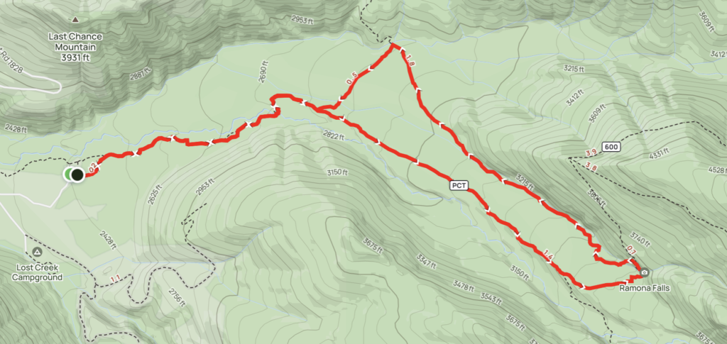
We’d settled on a few hikes enabling us to sample some sites – Ramona Falls, ZigZag Canyon, and Tom, Dick, and Harry Mountain (yes, that’s the name of it).
Ramona Falls
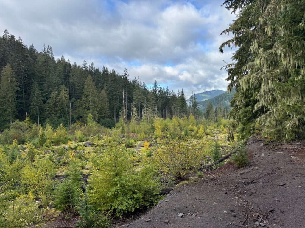
The weather for the morning seemed somewhat threatening – with low cloud cover (in the clouds under somewhat clear skies?). We chose to do Ramona Falls – a 7.2 miler with about 1,075 ft of elevation gain. While the internet said it had good views of Mt. Hood – that wasn’t to be for us. It was mostly a woods walk, without any views of the distant summit.
We parked at the Ramona Falls trailhead – about 15 minutes off the main Rt. 26, running east-west on the south-side of Mt. Hood. It being a weekday, the large-ish parking lot was fairly empty, so we were quickly geared up and on our way.
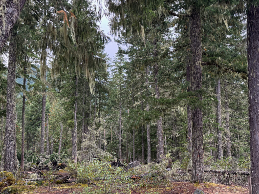
Surprising early on was the lichen ‘forest’, covering nearly all trees, almost a feeling of trees dripping lichen – perhaps from the locally-damp climate creating water dripping and feeding the lichen growth. Either way, an interesting sight:
The trail itself, a small section of the Pacific Crest Trail, followed the Sandy River for a bit, clearly creating a ‘valley’ between wooded banks on either side. We were a bit early for some of the fall foliage, though we could imagine it in full ‘bloom’:
At one point, we needed to cross the Sandy River, fortunately facilitated by some downed tree trunks. More woods walking with moderate elevation gain, and we eventually emerged at the Ramona Falls – a beautiful sight to see:
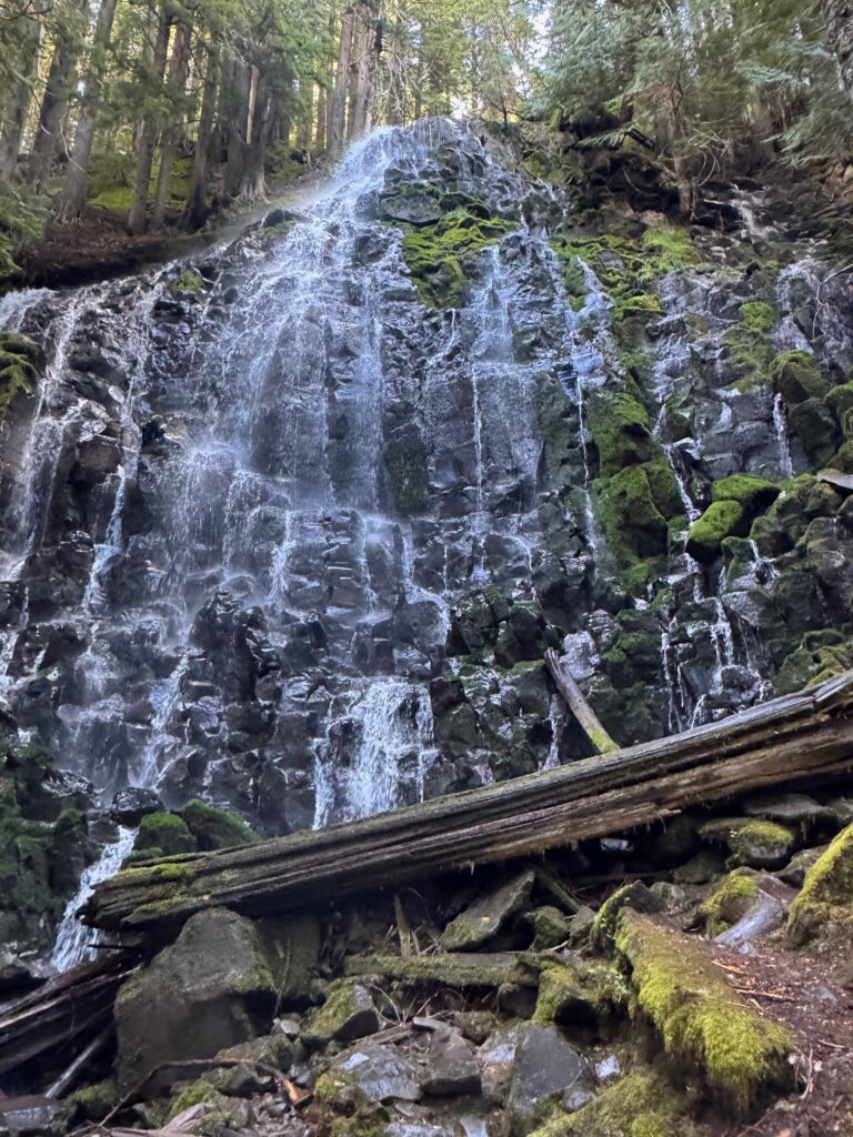
The falls was the furthest point from the parking lot and was the turning around point to head back following the Ramona Falls trail (northern part of the lollipop loop).
In all, a very “pleasant” hike – not too strenuous, providing some good elevation gain, and probably some good views – but we’ll never know 🙁
ZigZag Canyon Rim
The predicted weather was set to improve somewhat during the afternoon, so instead of calling it a day, we headed further eastward on Rt. 26 to the Timberline Lodge to tack on the ZigZag Canyon Rim hike – and take advantage of the improving/clearing weather.
The trail/hike was ‘moderate’ – 4.7 miles with about 900ft of elevation gain – so doing back-to-back hikes on the same day was maybe a bit aggressive. Taken together, we were almost at the upper limit of our day hikes – though not “massive” like some of our other adventures (such as Paintbrush Divide in the Tetons, Gabas to Gourette in the Pyrenees, or even Mt Katahdin on the New England 67 list.
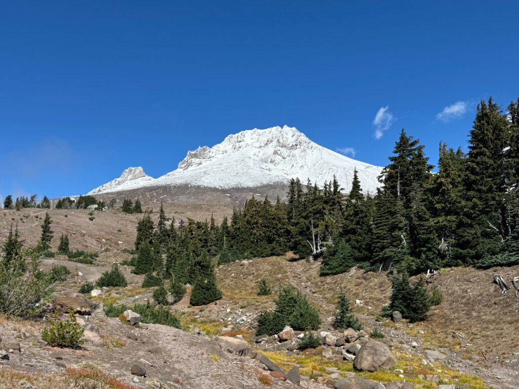
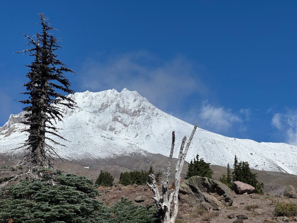
We’re really happy we did this hike. While not completely clear, the weather cleared enough to give us some breathtaking views of Mt Hood.
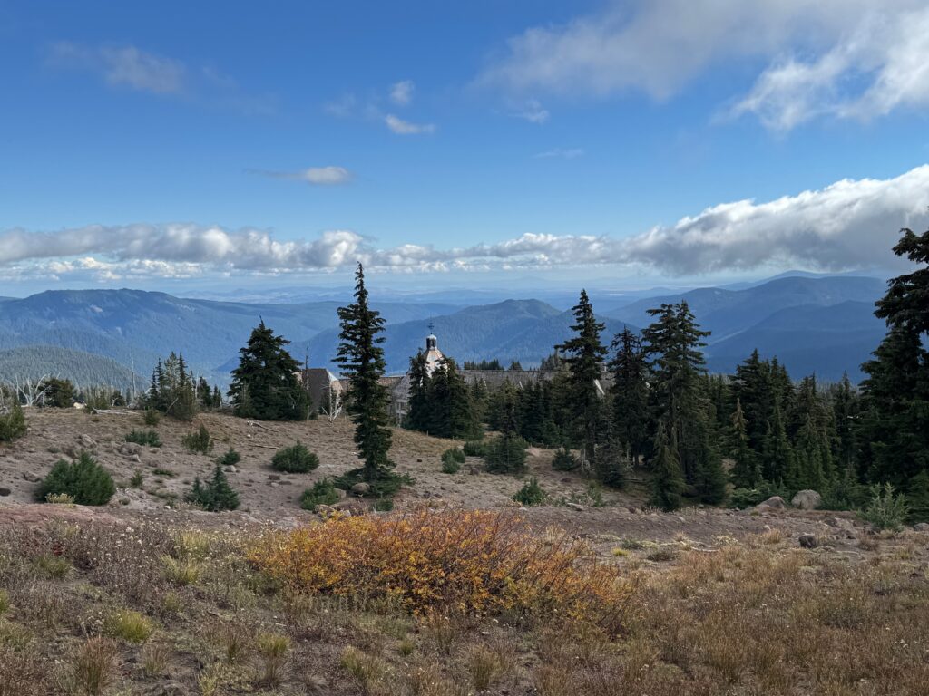
The trailhead was at the Timberline Lodge, a ski resort/base lodge, found at the end of the Timberline highway at nearly 6,000ft. During low seasons, ski lodges always seem to have a sleepy kind of vibe – not much in the way of activity, with various pieces open or in disrepair in preparation for the high season and throngs of people.
This was no exception – the parking lot was only sparsely filled, with some day hikers (ourselves included) and viewing – the view from the lot was pretty fantastic!
Leaving from the parking lot, we quickly joined with the Pacific Crest trail, and needed to decide whether to head to Canada or Mexico – perhaps a nod to our current political climate – escape if you can!
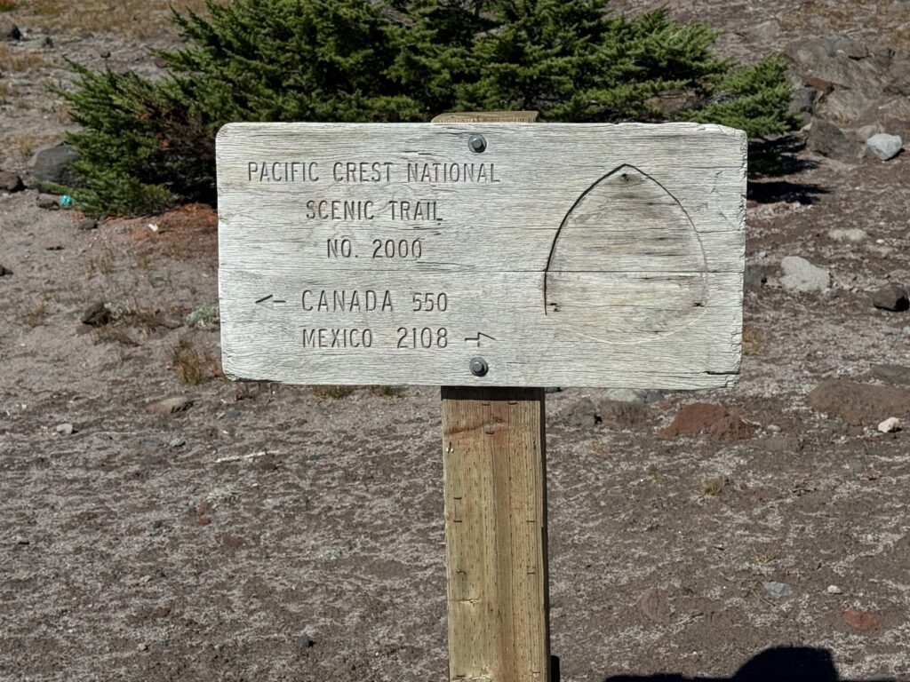
We chose Canada and were almost immediately treated to hints of Mt Hood itself peaking through the low flying clouds, making this short, moderate hike a real treat.
The trail itself was in fine condition, offering easy footing, no boulders and only infrequent steeper, though short, ascents.
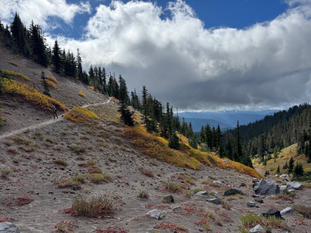
In all, a relatively easy hike, with stunning views and a great way to cap our first day in the Mt Hood National Forest.
View this trail on alltrails.com.
Mirror Lake
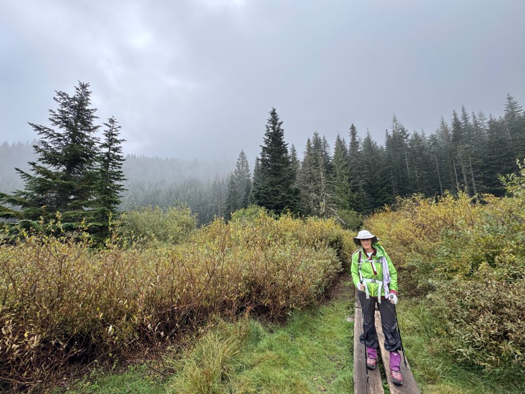
Our plan had been to summit “Tom, Dick, and Harry Mountain” – yes, there is such a mountain in Oregon!, but the weather and a bum knee weren’t too cooperative, so we opted for the shorter and less “aggressive” (aka, easier) Mirror Lake. At 4.2 miles and about 650ft of elevation change, it was a good “leg stretcher”.
The first portion of the trail descended from the parking area via a few switchbacks was even paved up until the first footbridge over a stream. From there, the the trail was wide and uncluttered with rocks, roots, etc.
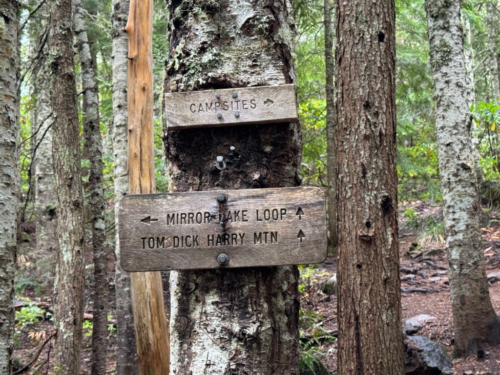
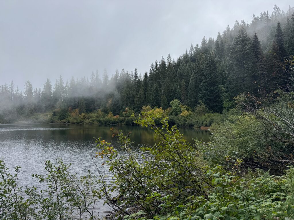
Shortly after the junction, the lake emerged – though the day’s weather wasn’t particularly good – in the clouds under mostly cloudy skies. Some online photos did show views of Mt. Hood from around the lake, though we didn’t get any on our visit.
Despite the weather, the hike itself was pleasant enough – always a good day out.
And soon enough, we were back at the junction and heading back to the parking lot.
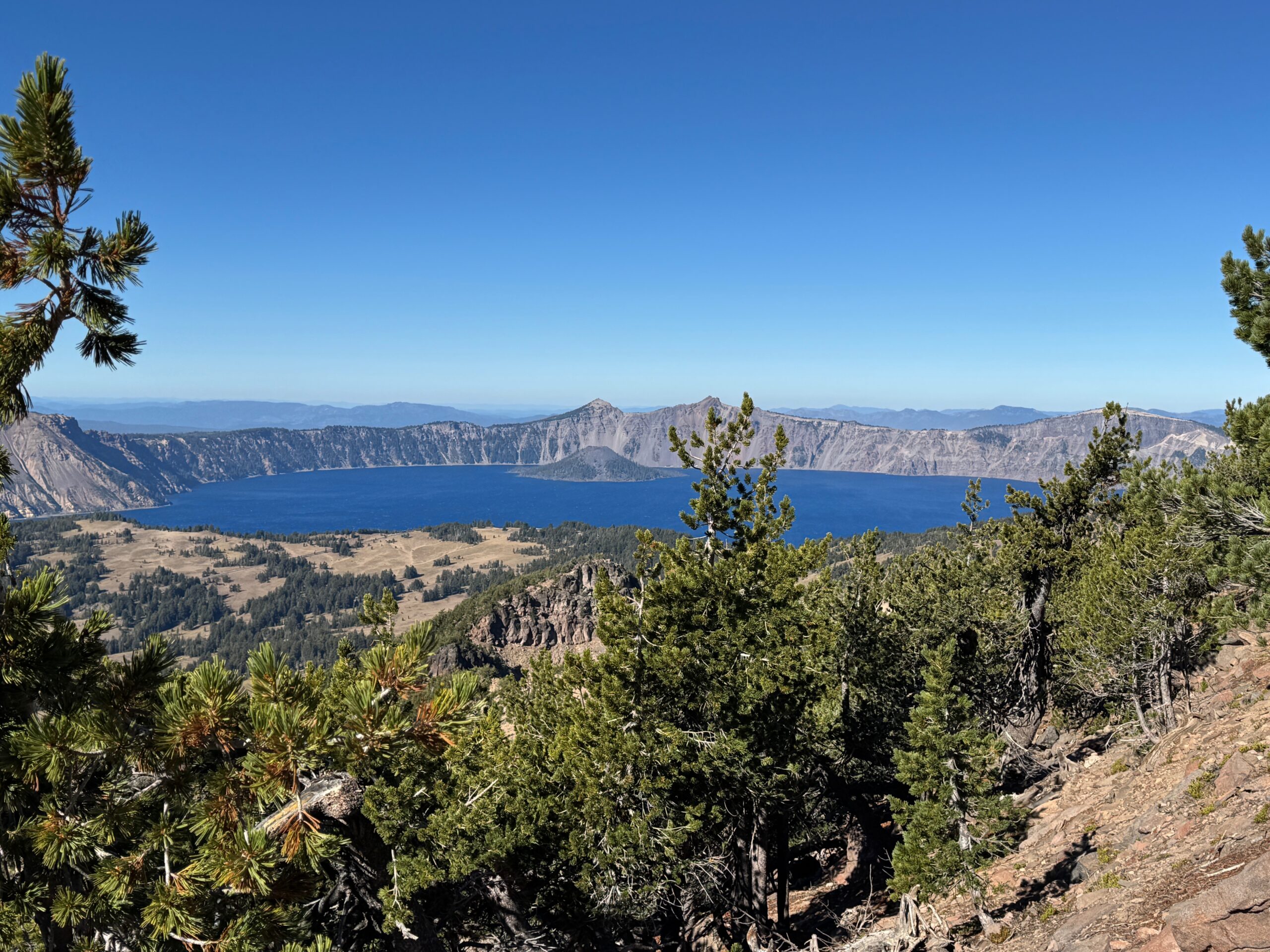
And with that, we concluded our visit to the Mt. Hood national forest, and prepared for our drive to Crater Lake National Park.
Explore other posts from this trip: